Mount Hope River
| Mount Hope River | |
| River | |
| Country | United States |
|---|---|
| State | Connecticut |
| Counties | Tolland, Windham |
| Source | Morey Pond |
| - location | Ashford, Windham County, Connecticut, United States |
| - elevation | 980 ft (299 m) approx. |
| - coordinates | 41°57′29″N 72°11′28″W / 41.95799°N 72.19103°W |
| Mouth | Mansfield Hollow Lake |
| - location | Mansfield, Tolland County, Connecticut, United States |
| - elevation | 256 ft (78 m) |
| - coordinates | 41°46′35″N 72°10′35″W / 41.77627°N 72.17627°WCoordinates: 41°46′35″N 72°10′35″W / 41.77627°N 72.17627°W |
| Length | 15 mi (24 km) approx. |
| Basin | 28 sq mi (73 km2) approx. |
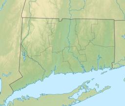
The Mount Hope River is a river in northeastern section of the U.S. state of Connecticut. The river is formed at the outlet of Morey Pond at the extreme northern end of Ashford, Connecticut, at the border of Union, Connecticut, and flows about 15 miles (24 km) south to Mansfield Hollow Lake, just south of Mansfield, Connecticut.
The Mount Hope River begins at the dam which releases water from Morey Pond, at the Ashford-Union border, adjacent to Interstate 84. From here, the river flows south through Ashford, roughly paralleling Route 89, and passing under this road several times. The Mount Hope River passes through the hamlets of Westford and Warrenville. After passing through Warrenville, the river continues to flow south, and enters Mansfield, still paralleling Route 89. The Mount Hope River continues flowing south through the eastern portion of Mansfield, following Route 89, and eventually reaches its mouth at Mansfield Hollow Lake, just south of where it passes under Atwoodville Road.
A popular whitewater paddling route starts along Route 89 about 1/10 of a mile north of the junction with U.S. Route 44. After about 1-mile (1.6 km) of mostly quickwater, the river flows through occasional Class II whitewater with difficult Class III whitewater near Mansfield Hollow Lake for a total of about 7 miles (11 km) of whitewater paddling.
The Mount Hope River watershed covers an area of approximately 28 square miles in northeastern Connecticut. Most of this watershed is located in Ashford, Connecticut, but portions of it also lie in the northeastern section of Mansfield, the northwestern section of Chaplin, and the southern section of Union.
...
Wikipedia

