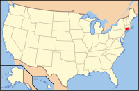
Windham County, Connecticut
| Windham County, Connecticut | |
|---|---|

The Windham Town Hall, and former county courthouse
|
|
 Location in the U.S. state of Connecticut |
|
 Connecticut's location in the U.S. |
|
| Founded | May 12, 1726 |
| Seat |
none (1960-present) Willimantic (1893-1960) Windham (1726-1893) |
| Largest town | Windham |
| Area | |
| • Total | 521 sq mi (1,349 km2) |
| • Land | 513 sq mi (1,329 km2) |
| • Water | 8.5 sq mi (22 km2), 1.6% |
| Population (est.) | |
| • (2015) | 116,573 |
| • Density | 231/sq mi (89/km²) |
| Area code(s) | 860 and 959 |
| Congressional district | 2nd |
| Time zone | Eastern: UTC-5/-4 |
none (1960-present) Willimantic (1893-1960)
Windham County is a county located in the northeastern corner of the U.S. state of Connecticut. As of the 2010 census, the population was 118,428, making it the least populous county in Connecticut. It forms the core of the region known as the Quiet Corner.
Windham County is included in the Worcester, MA-CT Metropolitan Statistical Area, which is also included in the Boston-Worcester-Providence, MA-RI-NH-CT Combined Statistical Area.
The entire county is within the Quinebaug and Shetucket Rivers Valley National Heritage Corridor, as designated by the National Park Service.
The area that is now Windham County became of interest to the English around 1635, but went unsettled for over fifty years due to its lack of access to the shore. John Winthrop took a strong interest to this land, purchased land from the Narragansetts, and was given permission by the court of Connecticut to settle in October 1671. In 1678, a tract of land, called Joshua’s Tract (Joshua was the son of Mohegan chief Uncas), was willed to Connecticut officials, and in February 1682, it was gifted to Samuel and Daniel Mason. In 1684, 1200 acres of land was sold to Jonathan Curtis, Thomas Dudley, and Samuel, among others, by the Nipmunks.
Windham County was created from Hartford and New London counties on 12 May 1726 by an act of the Connecticut General Court. The act establishing the county states:
...
Wikipedia
