Montezuma County, Colorado
| Montezuma County, Colorado | |
|---|---|

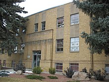
Montezuma County Courthouse
|
|
 Location in the U.S. state of Colorado |
|
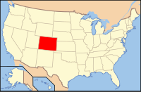
 Colorado's location in the U.S. |
|
| Founded | April 16, 1889 |
| Named for | Moctezuma II |
| Seat | Cortez |
| Largest city | Cortez |
| Area | |
| • Total | 2,040 sq mi (5,284 km2) |
| • Land | 2,030 sq mi (5,258 km2) |
| • Water | 11 sq mi (28 km2), 0.5% |
| Population (est.) | |
| • (2015) | 26,168 |
| • Density | 12/sq mi (5/km²) |
| Congressional district | 3rd |
| Time zone | Mountain: UTC-7/-6 |
| Website | montezumacounty |
Montezuma County is the southwesternmost of the 64 counties in the U.S. state of Colorado. As of the 2010 census, the population was 25,535. The county seat is Cortez.
Mesa Verde National Park, Canyons of the Ancients National Monument, Yucca House National Monument, and Hovenweep National Monument preserve hundreds of ancient Amerindian structures, including the famous cliff-dwellings, found in the county. Montezuma County is also home to most of the Ute Mountain Indian Reservation, home of the Weeminuche Band of the Ute Nation, known as the Ute Mountain Ute Tribe, with its headquarters at Towaoc.
Montezuma County has been settled since approximately AD 600, and had an estimated population of approximately 100,000, four times its current population, in the 12th century. However, a series of events caused virtually all permanent settlements to be abandoned between 1200 and 1300, and the area was contested between nomadic Ute and Navajo bands until resettlement occurred in the 1870s. Montezuma County was created out of the western portion of La Plata County by the Colorado Legislature in April 1889. It was named in honor of a famous chief of the Aztec Indians in Mexico, Moctezuma II. The building ruins in Mesa Verde National Park were thought to be of Aztec origin at the time.
...
Wikipedia
