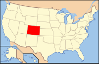
La Plata County, Colorado
| La Plata County, Colorado | |
|---|---|
 Location in the U.S. state of Colorado |
|
 Colorado's location in the U.S. |
|
| Founded | February 10, 1874 |
| Named for | Spanish language word for silver |
| Seat | Durango |
| Largest city | Durango |
| Area | |
| • Total | 1,700 sq mi (4,403 km2) |
| • Land | 1,692 sq mi (4,382 km2) |
| • Water | 7.6 sq mi (20 km2), 0.4% |
| Population (est.) | |
| • (2015) | 54,688 |
| • Density | 30/sq mi (12/km²) |
| Congressional district | 3rd |
| Time zone | Mountain: UTC-7/-6 |
| Website | co |
La Plata County is one of the 64 counties in the U.S. state of Colorado. As of the 2010 census, the population was 51,334. The county seat is Durango. The county was named for the La Plata River and the La Plata Mountains. "La plata" is the Spanish language word for "silver".
La Plata County comprises the Durango, CO Micropolitan Statistical Area.
The county is home to Durango Rock Shelters Archeology Site, the type site for the Basketmaker II period of Anasazi culture.
According to the U.S. Census Bureau, the county has a total area of 1,700 square miles (4,400 km2), of which 1,692 square miles (4,380 km2) is land and 7.6 square miles (20 km2) (0.4%) is water.
As of the census of 2000, there are 43,941 people in the county, organized into 17,342 households and 10,890 families. The population density is 26 people per square mile (10/km²). There are 20,765 housing units at an average density of 12 per square mile (5/km²). The racial makeup of the county is 87.31% White, 5.78% Native American, 0.40% Asian, 0.31% Black or African American, 0.05% Pacific Islander, 3.90% from other races, and 2.25% from two or more races. 10.40% of the population are Hispanic or Latino of any race.
...
Wikipedia
