Monghsu
| Monghsu (Mönghsu) | |||||
| State of the Shan States in personal union with Mongsang | |||||
|
|||||
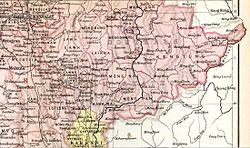
| Möng Hsu State in an Imperial Gazetteer of India map | |||||
| History | |||||
| • | State founded | 1857 | |||
| • | Abdication of the last Myoza | 1959 | |||
| Area | |||||
| • | 1901 | 425 km2(164 sq mi) | |||
| Population | |||||
| • | 1901 | 17,480 | |||
| Density | 41.1 /km2 (106.5 /sq mi) | ||||
Monghsu or Maingshu was a Shan state in what is today Burma. It belonged to the Eastern Division of the Southern Shan States. The main river in the area was the Nam Pang.
Monghsu became independent from Hsenwi in 1857 under a personal union with the neighbouring state of Mongsang. It was a tributary of Burma until 1887, when the Shan states submitted to British rule after the fall of the Konbaung dynasty. The residence of the Myoza was at Mong Hsu.
The rulers of Monghsu/Möngsang bore the title of Myoza.
Coordinates: 21°48′N 98°21′E / 21.800°N 98.350°E
...
Wikipedia

