Miller County, Arkansas
| Miller County, Arkansas | |
|---|---|

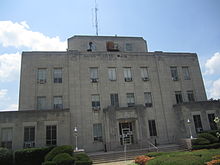
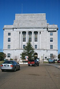
Miller County Courthouse in Texarkana
|
|
 Location in the U.S. state of Arkansas |
|
 Arkansas's location in the U.S. |
|
| Founded | April 1, 1820; recreated December 22, 1874, following abolishment in 1838 |
| Named for | James Miller |
| Seat | Texarkana |
| Largest city | Texarkana |
| Area | |
| • Total | 638 sq mi (1,652 km2) |
| • Land | 626 sq mi (1,621 km2) |
| • Water | 12 sq mi (31 km2), 1.9% |
| Population (est.) | |
| • (2015) | 43,908 |
| • Density | 70/sq mi (27/km²) |
| Congressional district | 4th |
| Time zone | Central: UTC-6/-5 |
| Website | www |
 |
|
|
|
|
|
|
Miller County is a county located in the southwestern corner of the U.S. state of Arkansas. As of the 2010 census, the population was 43,462. The county seat is Texarkana.
Miller County is part of the Texarkana, TX-AR, Metropolitan Statistical Area.
When first formed, Miller County was Arkansas's sixth county, established on April 1, 1820, and named for James Miller, the first governor of the Arkansas Territory. Additionally, Miller County was the first of the state's counties to be formed upon the creation of the Arkansas Territory. The first five — Arkansas, Lawrence, Clark, Hempstead and Pulaski — were formed during Arkansas's days as part of the Missouri Territory. The county was abolished in 1838, and later recreated on December 22, 1874 from a portion of neighboring Lafayette County. [1]
Despite its proximity to Texas (which has no state personal income tax), Miller County residents are not exempt from Arkansas's state personal income tax unless they reside within the city limits of Texarkana. Miller County is also one of only two counties in Arkansas (along with Little River County) to be separated from all surrounding counties in the state by water — the Red River, in this case.
...
Wikipedia
