Middleville, Michigan
| Middleville, Michigan | |
|---|---|
| Village | |
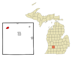
 Location of Middleville, Michigan |
|
| Coordinates: 42°42′54″N 85°27′53″W / 42.71500°N 85.46472°W | |
| Country | United States |
| State | Michigan |
| County | Barry |
| Area | |
| • Total | 2.40 sq mi (6.22 km2) |
| • Land | 2.28 sq mi (5.91 km2) |
| • Water | 0.12 sq mi (0.31 km2) |
| Elevation | 764 ft (233 m) |
| Population (2010) | |
| • Total | 3,319 |
| • Estimate (2012) | 3,309 |
| • Density | 1,455.7/sq mi (562.0/km2) |
| Time zone | Eastern (EST) (UTC-5) |
| • Summer (DST) | EDT (UTC-4) |
| ZIP code | 49333 |
| Area code(s) | 269 |
| FIPS code | 26-53760 |
| GNIS feature ID | 0632281 |
Middleville is a village in Thornapple Township, Barry County in the U.S. state of Michigan and part of the Grand Rapids Metropolitan area. The population was 3,319 at the 2010 census.
The first white settler to own land in the village was Calvin G. Hill, a native of New York, who bought 400 acres (1.6 km2) in 1834 on both sides of the Thornapple River. The village was likely surveyed and subdivided before 1850, but the plat was not officially recorded until 1859. Prior to 1843, the settlement was often called "Thornapple". The name Middleville was at first given to a post office on the stage coach line between Grand Rapids and Kalamazoo. The post office was located at the house of Benjamin S. Dibble in section 2 in northeast Yankee Springs Township. Dibble had agreed to accept the post office at the request of U.S. Representative Lucius Lyon, of Kent County. Lyon suggested the name "Dibbleville", but Dibble disliked that name. "Middleville" was suggested because of the proximity of an Indian village known as "Middle Village" on Scales Prairie near the boundary line between Thornapple and Yankee Springs townships. Dibble was appointed postmaster in July 1839 and continued until 1842. The next postmaster, John W. Bradley, continued to maintain the post office at Dibble's house until 1843, when it was moved to the present village of Middleville, with Calvin G. Hill as the postmaster. The village afterwards became known by the name of the post office. The location of the original Indian village is NNE a few hundred yards of the present day intersection where Norris Rd. ends at Adams Rd.http://www.dnr.state.mi.us/spatialdatalibrary/pdf_maps/glo_plats/barry/04n10w.pdf
...
Wikipedia
