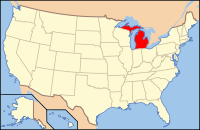
Kent County, Michigan
| Kent County, Michigan | ||
|---|---|---|

Kent County Courthouse
|
||
|
||
 Location in the U.S. state of Michigan |
||
 Michigan's location in the U.S. |
||
| Founded | March 2, 1831 (created) 1836 (organized) |
|
| Named for | James Kent | |
| Seat | Grand Rapids | |
| Largest city | Grand Rapids | |
| Area | ||
| • Total | 872 sq mi (2,258 km2) | |
| • Land | 847 sq mi (2,194 km2) | |
| • Water | 25 sq mi (65 km2), 2.9% | |
| Population (est.) | ||
| • (2015) | 636,369 | |
| • Density | 712/sq mi (275/km²) | |
| Congressional districts | 2nd, 3rd | |
| Time zone | Eastern: UTC-5/-4 | |
| Website | www |
|
Kent County is a county in the U.S. state of Michigan. As of the 2010 census, the county had a population of 602,622. Its county seat is Grand Rapids. The county was set off in 1831, and organized in 1836. It is named for New York jurist and legal scholar James Kent, who represented the Michigan Territory in its dispute with Ohio over the Toledo Strip.
Kent County is part of the Grand Rapids–Wyoming, MI Metropolitan Statistical Area.
Kent County is West Michigan's economic and manufacturing center, with the Steelcase corporation based in the county. It is also the home of the Frederik Meijer Gardens, a significant cultural landmark of the Midwest. The county is a traditional stronghold for the Republican Party, with a substantial conservative population, but in 2008, Barack Obama became the first Democratic presidential candidate to carry the county since 1964. The Gerald R. Ford International Airport is within the county.
The Grand River runs through the county. On its west bank are burial mounds, remnants of the Hopewell Indians who lived there. The river valley was an important center for the fur trade in the early 19th century. After the War of 1812, Rix Robinson and Louis Campau were the earliest traders in the area. In 1826, Campau established a trading post in what is today Grand Rapids. In 1831, he bought land and platted the town. Campau considered the town's "father". One year later, government surveyor Lucius Lyon purchased land north of Campau's property. Campau surveyed and platted the village following Native American trails and Lyon had platted his property in an English grid format, which meant there were two adjoining villages, with different platting formats. Campau later merged the villages under the name of Grand Rapids.
...
Wikipedia

