Grand Rapids-Wyoming metropolitan area
|
Grand Rapids metropolitan area Grand Rapids–Wyoming MSA Grand Rapids–Muskegon–Holland CSA |
|
|---|---|
| CSA | |

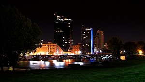
Grand Rapids Riverfront
|
|
| Coordinates: 42°58′13″N 85°40′09″W / 42.9703°N 85.6691°W | |
| Country |
|
| State |
|
| Largest city | Grand Rapids |
| Counties | |
| Population (2015) | |
| • MSA | 1,038,583 |
| • CSA | 1,433,288 |
| Time zone | EST (UTC-5) |
| • Summer (DST) | EDT (UTC-4) |
The Grand Rapids metropolitan area is a triangular shaped Metro Triplex, in West Michigan, which fans out westward from the primary hub city of Grand Rapids, Michigan to the other two metro hubs of Muskegon and Holland. As of 2015, the metropolitan area has an estimated population of 1,038,583. The region, noted in particular for its western edge abutting the Lake Michigan shoreline and its beaches, is a popular tourist and vacation destination during the summer. Noted popular metro area beach towns include Grand Haven, Holland, Muskegon, and Saugatuck.
The metropolitan area is home to many attractions. Frederik Meijer Gardens & Sculpture Park is located in the outskirts of Grand Rapids. Michigan's Adventure theme park is just north of Muskegon, and the Grand Rapids Art Museum and the DeVos Place Convention Center are both in downtown Grand Rapids. The Grand River flows through the metropolitan area and is noted for its fishing, kayaking, and canoeing.
The Grand Rapids-Wyoming Metropolitan Statistical Area, as defined by the United States Census Bureau, is an area consisting of four counties in western Michigan, anchored by the cities of Grand Rapids and Wyoming. The MSA has a population of 1,027,703. It comprises four counties which include Barry, Kent, Montcalm, and Ottawa.
...
Wikipedia
