Ottawa County, Michigan
| Ottawa County, Michigan | ||
|---|---|---|
|
||
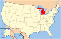
 Location in the U.S. state of Michigan |
||
 Michigan's location in the U.S. |
||
| Founded | 1837 | |
| Named for | Ottawa Nation | |
| Seat | Grand Haven | |
| Largest city | Holland | |
| Area | ||
| • Total | 1,631 sq mi (4,224 km2) | |
| • Land | 563 sq mi (1,458 km2) | |
| • Water | 1,068 sq mi (2,766 km2), 65% | |
| Population (est.) | ||
| • (2014) | 279,955 | |
| • Density | 468/sq mi (181/km²) | |
| Congressional district | 2nd | |
| Time zone | Eastern: UTC-5/-4 | |
| Website | www |
|
Ottawa County is a county located in the U.S. state of Michigan. As of the 2010 census, the population was 263,801. The county seat is Grand Haven. The county is named for the Ottawa Nation. It was set off in 1831 and organized in 1837.
Ottawa County is included in the Grand Rapids-Wyoming, MI Metropolitan Statistical Area.
According to the U.S. Census Bureau, the county has a total area of 1,631 square miles (4,220 km2), of which 563 square miles (1,460 km2) is land and 1,068 square miles (2,770 km2) (65%) is water.
As of the 2010 United States Census, there were 263,801 people residing in the county. 90.1% were White, 2.6% Asian, 1.5% Black or African American, 0.4% Native American, 3.4% of some other race and 2.0% of two or more races. 8.6% were Hispanic or Latino (of any race). 31.0% were of Dutch, 14.2% German, 5.8% English and 5.7% Irish ancestry.
...
Wikipedia

