Barry County, Michigan
| Barry County, Michigan | ||
|---|---|---|

Barry County Courthouse
|
||
|
||
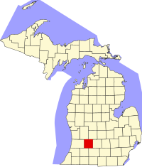
 Location in the U.S. state of Michigan |
||
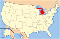
 Michigan's location in the U.S. |
||
| Founded | April 29, 1829 (founded) 1839 (organized) |
|
| Named for | William Taylor Barry | |
| Seat | Hastings | |
| Largest city | Hastings | |
| Area | ||
| • Total | 577 sq mi (1,494 km2) | |
| • Land | 553 sq mi (1,432 km2) | |
| • Water | 24 sq mi (62 km2), 4.2% | |
| Population | ||
| • (2010) | 59,173 | |
| • Density | 107/sq mi (41/km²) | |
| Congressional district | 3rd | |
| Time zone | Eastern: UTC-5/-4 | |
| Website | www |
|
Barry County is a county in the U.S. state of Michigan. As of the 2010 census, the population was 59,173. The county seat is Hastings. The county was formed by an act of the legislature of the Michigan Territory on April 29, 1829 and organized in 1839. It was named for William Taylor Barry, United States Postmaster General under President Andrew Jackson, making it one of Michigan's "cabinet counties". There was once several railroads that went through the county. The main schools are Hastings elementary, middle and high schools; Delton with its elementary, middle and high schools; and Middleville with its elementary, middle and high schools.
Barry County is part of the Grand Rapids-Wyoming, MI Metropolitan Statistical Area.
According to the U.S. Census Bureau, the county has a total area of 577 square miles (1,490 km2), of which 553 square miles (1,430 km2) is land and 24 square miles (62 km2) (4.2%) is water.
As of the 2010 United States Census, there were 59,173 people residing in the county. 96.9% were White, 0.5% Native American, 0.4% Black or African American, 0.4% Asian, 0.6% of some other race and 1.3% of two or more races. 2.3% were Hispanic or Latino (of any race). 19.8% were of German, 13.5% American, 12.1% English, 11.2% Dutch and 8.1% Irish ancestry.
...
Wikipedia

