Meuse (department)
| Meuse | ||
|---|---|---|
| Department | ||

Prefecture building of the Meuse department, in Bar-le-Duc
|
||
|
||
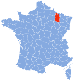
 Location of Meuse in France |
||
| Coordinates: 49°00′N 05°20′E / 49.000°N 5.333°ECoordinates: 49°00′N 05°20′E / 49.000°N 5.333°E | ||
| Country | France | |
| Region | Grand Est | |
| Prefecture | Bar-le-Duc | |
| Subprefectures |
Commercy Verdun |
|
| Government | ||
| • President of the General Council | Christian Namy | |
| Area | ||
| • Total | 6,211 km2 (2,398 sq mi) | |
| Population (2013) | ||
| • Total | 192,094 | |
| • Rank | 89th | |
| • Density | 31/km2 (80/sq mi) | |
| Time zone | CET (UTC+1) | |
| • Summer (DST) | CEST (UTC+2) | |
| Department number | 55 | |
| Arrondissements | 3 | |
| Cantons | 17 | |
| Communes | 501 | |
| ^1 French Land Register data, which exclude estuaries, and lakes, ponds, and glaciers larger than 1 km2 | ||
Meuse (French pronunciation: [møz]) is a department in northeast France, named after the River Meuse. Meuse is part of the current region of Grand Est and is surrounded by the French departments of Ardennes, Marne, Haute-Marne, Vosges, Meurthe-et-Moselle, and has a short border with Belgium on the north. Parts of Meuse belong to Parc naturel régional de Lorraine. Front lines in trench warfare during World War I ran varying courses through the department and it hosted an important battle/offensive in 1916 in and around Verdun.
Meuse is one of the original 83 departments created during the French Revolution on 4 March 1790, by order of the National Constituent Assembly. The new departments were to be uniformly administered and approximately equal to one another in size and population. The department was created from the former provinces of Barrois (area of Bar-le-Duc) and Three Bishoprics (area of Verdun).
From about 500 AD, the Franks controlled this part of northeastern France, and the Carolingian Empire was the last stage of their rule. The Carolingian territories were divided into three sections in 843 at the Treaty of Verdun, and the area that is now the department of Meuse, became part of Middle Francia. The new ruler was Lothair I, and on his death in 855, his territory north of the Alps was passed to his second son Lothair II, after whom the hitherto nameless territory was called Lotharingia, which name eventually evolved into the modern Lorraine. Lothair II died without legitimate heirs and Lotharingia was divided into an east and west part. The king of East Francia, Louis the German, received the eastern part and Charles the Bald, king of West Francia, received the western part, which included Meuse, thus effectively establishing the medieval Kingdoms of Germany and France.
...
Wikipedia

