Menghai County
| Menghai County | |
|---|---|
| County | |
| Chinese transcription(s) | |
| • Characters | 勐海县 |
| • Pinyin | Měnghǎi Xiàn |
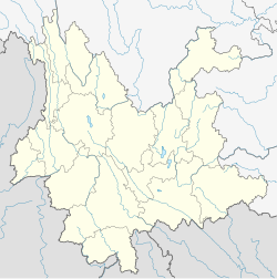
 Location of Menghai County (pink) and Xishuangbanna Prefecture (yellow) within Yunnan province of China |
|
| Location in Yunnan, China | |
| Coordinates: 21°58′N 100°28′E / 21.967°N 100.467°E | |
| Country | China |
| Province | Yunnan |
| Prefecture | Xishuangbanna |
| 532822 | |
| Area | |
| • Total | 5,511 km2 (2,128 sq mi) |
| Population | |
| • Total | 292,383 |
| • Density | 53/km2 (140/sq mi) |
| Time zone | China Standard Time (UTC+8) |
| Postal code | 666200 |
| Area code(s) | 0691 |
| Climate | Cwa |
| Website | http://www.mhfgj.gov.cn/ |
|
1Yunnan Statistics Bureau [1] 2Xishuangbanna Gov. [2] 3Yunnan Portal [3] |
|
Menghai County (勐海县; pinyin: Měnghǎi Xiàn) (Thai: เมิ้งฮาย, เมืองฮาย) is a county under the jurisdiction of Xishuangbanna Dai Autonomous Prefecture, Yunnan province, China. Meng is as variation of Mueang.
In and around Menghai County, ethnic Hani subgroups include:
Coordinates: 21°58′00″N 100°28′00″E / 21.9667°N 100.4667°E
...
Wikipedia

