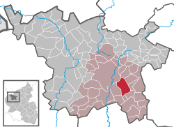
Mehren, Vulkaneifel
| Mehren | ||
|---|---|---|
|
||
| Coordinates: 50°10′38″N 6°52′40″E / 50.17732°N 6.87779°ECoordinates: 50°10′38″N 6°52′40″E / 50.17732°N 6.87779°E | ||
| Country | Germany | |
| State | Rhineland-Palatinate | |
| District | Vulkaneifel | |
| Municipal assoc. | Daun | |
| Government | ||
| • Mayor | Josef Ring | |
| Area | ||
| • Total | 12.95 km2 (5.00 sq mi) | |
| Elevation | 450 m (1,480 ft) | |
| Population (2015-12-31) | ||
| • Total | 1,451 | |
| • Density | 110/km2 (290/sq mi) | |
| Time zone | CET/CEST (UTC+1/+2) | |
| Postal codes | 54552 | |
| Dialling codes | 06592 | |
| Vehicle registration | DAU | |
| Website | www.mehren.de | |
Mehren is an Ortsgemeinde – a municipality belonging to a Verbandsgemeinde, a kind of collective municipality – in the Vulkaneifel district in Rhineland-Palatinate, Germany. It belongs to the Verbandsgemeinde of Daun, whose seat is in the like-named town.
The municipality lies in the Vulkaneifel, a part of the Eifel known for its volcanic history, geographical and geological features, and even ongoing activity today, including gases that sometimes well up from the earth. Mehren also lies on the Autobahn A 1.
Yearly precipitation in Mehren amounts to 832 mm, which is high, falling into the highest third of the precipitation chart for all Germany. At 69% of the German Weather Service’s weather stations, higher figures are recorded. The driest month is April. The most rainfall comes in December. In that month, precipitation is 1.5 times what it is in April. Precipitation varies hardly at all and is distributed evenly throughout the year. Only at 0% of the weather stations are lower seasonal swings recorded.
The Mehren area is known to have been settled as early as late Hallstatt times, about 700 BCE. Archaeologists have named the finds from ancient settlements, because they show such a uniformity among themselves, after the biggest centre in the area, calling the artifacts part of the “Mehren culture”.
The remains of a Roman settlement were believed to have been found on the Mürmes (a moorland), and others have been confirmed near Schalkenmehren railway station and in Weinfeld. The Frankish settlement that followed the Roman period shows up mainly in grave finds and even in the traditional structures still seen today in the old village layout.
...
Wikipedia


