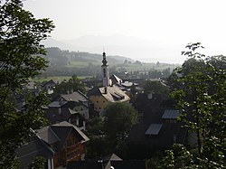
Mauterndorf
| Mauterndorf | ||
|---|---|---|
 |
||
|
||
| Location within Austria | ||
| Coordinates: 47°07′57″N 13°41′49″E / 47.13250°N 13.69694°ECoordinates: 47°07′57″N 13°41′49″E / 47.13250°N 13.69694°E | ||
| Country | Austria | |
| State | Salzburg | |
| District | Tamsweg | |
| Government | ||
| • Mayor | Wolfgang Eder (ÖVP) | |
| Area | ||
| • Total | 32.71 km2 (12.63 sq mi) | |
| Elevation | 1,123 m (3,684 ft) | |
| Population (1 January 2016) | ||
| • Total | 1,697 | |
| • Density | 52/km2 (130/sq mi) | |
| Time zone | CET (UTC+1) | |
| • Summer (DST) | CEST (UTC+2) | |
| Postal code | 5570 | |
| Area code | 06472 | |
| Vehicle registration | TA | |
| Website | www.mauterndorf.salzburg.at | |
Mauterndorf is a market town of the Tamsweg District in the Austrian state of Salzburg. The municipality also comprises the Katastralgemeinden Faningberg, Neuseß and Steindorf.
It is located in the centre of the Salzburg Lungau region, in the valley of the Southern Taurach River, a tributary of the Mur rising at the Radstädter Tauern Pass. In the north, the Niedere Tauern range forms a part of the main chain of the Alps. In the south, the Katschberg Roads via Sankt Michael leads to the Tauern Autobahn and the Katschberg Pass, crossing the Hohe Tauern range towards Carinthia.
The settlement arose from a Roman castra in the Noricum province, at the mountain road from Teurnia to the Radstädter Tauern Pass and Iuvavum (Salzburg). Mauterndorf was first mentioned in a 1002 deed, Mauterndorf Castle was acquired by the Salzburg archbishops in 1023, who set up a toll (Maut) station and ceded the inhabitants market rights in 1217. From the 15th century, the fortress was significantly enlarged as a stronghold at the behest of the archbishops Burkhard Weisbriach and Leonhard von Keutschach.
...
Wikipedia


