Matagorda County
| Matagorda County, Texas | |
|---|---|

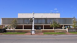
The Matagorda County Courthouse in Bay City
|
|
 Location in the U.S. state of Texas |
|
 Texas's location in the U.S. |
|
| Founded | 1836 |
| Seat | Bay City |
| Largest city | Bay City |
| Area | |
| • Total | 1,613 sq mi (4,178 km2) |
| • Land | 1,100 sq mi (2,849 km2) |
| • Water | 512 sq mi (1,326 km2), 32% |
| Population | |
| • Total | 36,807 |
| • Density | 33/sq mi (13/km²) |
| Congressional district | 27th |
| Time zone | Central: UTC-6/-5 |
| Website | www |
Matagorda County (/ˌmætəˈɡɔːrdə/) is a county located in the U.S. state of Texas. As of the 2010 census, the population was 36,702. According to data from Applied Geographic Solutions, the 2016 population was 36,807. Its county seat is Bay City, not to be confused with the larger Baytown in Harris and Chambers Counties. Matagorda County is named for the canebrakes that once grew along the coast (matagorda is a Spanish word meaning "thick bush").
Matagorda County comprises the Bay City, TX Micropolitan Statistical Area, which is also included in the Houston-The Woodlands, TX Combined Statistical Area.
According to the U.S. Census Bureau, the county has a total area of 1,613 square miles (4,180 km2), of which 1,100 square miles (2,800 km2) is land and 512 square miles (1,330 km2) (32%) is water. The water area includes Matagorda Bay. It borders the Gulf of Mexico.
As of 2016 data from Applied Geographic Solutions, there were 36,807 people, 14,425 households, and 9,824 families residing in the county. There were 19,267 housing units in the county with 14,425 occupied. The racial makeup of the county was 69.93% White, 11.56% Black or African American, 0.68% Native American, 2.24% Asian, 0.02% Pacific Islander, 13.02% from other races, and 2.53% from two or more races. 40.42% of the population were Hispanic or Latino of any race.
...
Wikipedia
