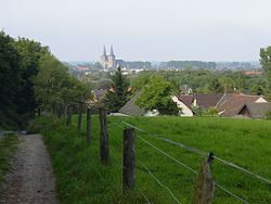
Marienbaum
| Xanten | ||
|---|---|---|
 |
||
|
||
| Coordinates: 51°39′44″N 06°27′14″E / 51.66222°N 6.45389°ECoordinates: 51°39′44″N 06°27′14″E / 51.66222°N 6.45389°E | ||
| Country | Germany | |
| State | North Rhine-Westphalia | |
| Admin. region | Düsseldorf | |
| District | Wesel | |
| • Mayor | (CDU) | |
| Area | ||
| • Total | 72.39 km2 (27.95 sq mi) | |
| Elevation | 50 m (160 ft) | |
| Population (2015-12-31) | ||
| • Total | 21,510 | |
| • Density | 300/km2 (770/sq mi) | |
| Time zone | CET/CEST (UTC+1/+2) | |
| Postal codes | 46509 | |
| Dialling codes | 0 28 01 und 0 28 04 (Marienbaum) | |
| Vehicle registration | WES | |
| Website | www.rathaus-xanten.de | |
Xanten (German pronunciation: [ˈksantən], Lower Franconian Santen) is a town in the state of North Rhine-Westphalia, Germany. It is located in the district of Wesel.
Xanten is known for the Archaeological Park, one of the largest archaeological open air museums in the world, built at the site of the Roman settlements Colonia Ulpia Traiana. Other attractions include the medieval town centre with Xanten Cathedral, many museums and large man-made lakes for various watersport activities. Xanten is visited by approximately one million tourists a year.
Xanten, the only German town whose name begins with X, is made up of three boroughs (Ortsteile): Hochbruch, Niederbruch, and the town centre. Other localities (Bezirke) belonging to the town of Xanten include Birten, Lüttingen, Marienbaum, Vynen, Obermörmter, Wardt, Mörmter, Willich, Beek and Ursel. Parts of a nature reserve called Bislicher Insel are located in the municipality as well.
The town borders the Lower Rhine and the town of Rees to the north, the town of Wesel to the east, the municipalities of Alpen and Sonsbeck to the south, and the towns of Uedem and Kalkar to the west.
The closest international airport is Airport Weeze, (also called Niederrhein Airport; Ryanair hub) is in Weeze (25 km); the closest intercontinental airport is Düsseldorf Airport (60 km)
...
Wikipedia


