Marcoussis
| Marcoussis | ||
|---|---|---|

The town hall in Marcoussis
|
||
|
||
| Coordinates: 48°38′33″N 2°13′51″E / 48.6424°N 2.2307°ECoordinates: 48°38′33″N 2°13′51″E / 48.6424°N 2.2307°E | ||
| Country | France | |
| Region | Île-de-France | |
| Department | Essonne | |
| Arrondissement | Palaiseau | |
| Canton | Montlhéry | |
| Government | ||
| • Mayor (2008–2014) | Olivier Thomas | |
| Area1 | 16.8 km2 (6.5 sq mi) | |
| Population (2006)2 | 7,863 | |
| • Density | 470/km2 (1,200/sq mi) | |
| Time zone | UTC+1 (UTC+1) | |
| • Summer (DST) | CEST (UTC+2) | |
| INSEE/Postal code | 91363 / | |
|
1 French Land Register data, which excludes lakes, ponds, glaciers > 1 km² (0.386 sq mi or 247 acres) and river estuaries. 2Population without double counting: residents of multiple communes (e.g., students and military personnel) only counted once. |
||
1 French Land Register data, which excludes lakes, ponds, glaciers > 1 km² (0.386 sq mi or 247 acres) and river estuaries.
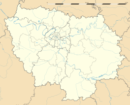
Marcoussis is a commune in the southern suburbs of Paris, France. It is located 24.8 km (15.4 mi) from the center of Paris.
Marcoussis is famous as the location of the CNR (National Centre of Rugby) where the French national rugby union team prepare for international competitions. It is at the CNR that the Linas-Marcoussis Agreement was signed in January 2003 between belligerents in the Ivorian Civil War.
A market village until the 1960s, Marcoussis supplied the markets of Paris with tomatoes and strawberries. A small train route, the Arpajonnais, inaugurated in 1894, took food at 4am every morning, it ceased functioning in 1937.
Marcoussis is located to the south of Paris, between trunk road RN20, in the east and Autoroute A10 to the west and trunk road RN104 called the Francilienne to the south. It is crossed by the RN446, and a small river of the Orge, called Sallemouille (previously called Gadanine).
Inhabitants are officially called the Marcoussissiens or according to other sources are called the Marcoussiens.
Historical population:
Very old traces of occupation exist, in particular a polishing machine found on the southern slope of the valley. The village really started to develop around the priory of Wandrille Saint, depending on the Abbey of Saint-Wandrille. In 854, a charter of Charles the Bald mentions Marcoussis. Initially, it would only be absolutely necessary for one vinyard at Bution, near to Arpajon. The monks losing Bution settled in Marcoussis at the beginning of the 12th century. The absence of records prevents an exact description of what was the priory at the time. It is known only that in 1298, there remained only one monk and that the village had 120 inhabitants. Célestins arrived at the beginning of the 15th century, and absorbed the possessions of the old ruined priory. But the history of Marcoussis also includes the construction desired by Jean de Montagu in 1404–1408. Minister of Finance for Charles VI of France he built his castle here (of which only the base and a tower remains, known as the Oubliettes), the convent of Célestins (remains of the cellars and a portion of the gate) and ordered the rebuilding of the village church. The church shelters a superb marble statue of the Virgin Mary donated by Jean de Berry to the convent of Célestins. The kings came to hunt at Marcoussis and there remains the royal house built under Louis XV. There was a commandry of the order of Saint Jean of Jerusalem from the 13th century (Brother Baudoyn commander of the "meson of the flood" in 1290); a vault is still visible. On the plateau close to Nozay, an important establishment of Alcatel shelters research laboratories.
...
Wikipedia


