Arpajon
| Arpajon | ||
|---|---|---|

The city hall
|
||
|
||
| Coordinates: 48°35′24″N 2°14′51″E / 48.59010°N 2.2476°ECoordinates: 48°35′24″N 2°14′51″E / 48.59010°N 2.2476°E | ||
| Country | France | |
| Region | Île-de-France | |
| Department | Essonne | |
| Arrondissement | Palaiseau | |
| Canton | Arpajon | |
| Intercommunality | Arpajon | |
| Government | ||
| • Mayor (2011–2020) | Christian Béraud | |
| Area1 | 2.40 km2 (0.93 sq mi) | |
| Population (2010)2 | 10,574 | |
| • Density | 4,400/km2 (11,000/sq mi) | |
| Time zone | CET (UTC+1) | |
| • Summer (DST) | CEST (UTC+2) | |
| INSEE/Postal code | 91021 /91290 | |
| Elevation | 47–89 m (154–292 ft) | |
|
1 French Land Register data, which excludes lakes, ponds, glaciers > 1 km² (0.386 sq mi or 247 acres) and river estuaries. 2Population without double counting: residents of multiple communes (e.g., students and military personnel) only counted once. |
||
1 French Land Register data, which excludes lakes, ponds, glaciers > 1 km² (0.386 sq mi or 247 acres) and river estuaries.
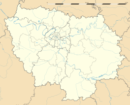
Arpajon ([aʁpaʒɔ̃]) is a French commune in the Essonne department in the Île-de-France region of northern France.
The inhabitants of the commune are known as Arpajonnais or Arpajonnaises.
The commune has been awarded three flowers by the National Council of Towns and Villages in Bloom in the Competition of cities and villages in Bloom.
Arpajon is the capital of a canton located in the Paris urban area in the heart of the department of Essonne and the natural region of Hurepoix some 31 km south-west of Paris (Notre-Dame - point zero for distances from Paris), 15 kilometres south-west of Évry, 40 km south of Palaiseau, 6 km south-west of Montlhéry, 40 km north-west of La Ferté-Alais, 19 km north-east of Dourdan, 17 km south-west of Corbeil-Essonnes, 19 km north-east of Étampes, and 26 km north-west of Milly-la-Forêt.
The commune is also 410 km north of its homonym Arpajon-sur-Cère in Cantal department., the original stronghold of the lords of the town.
...
Wikipedia


