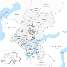
Manno
| Manno | ||
|---|---|---|
|
||
| Coordinates: 46°2′N 8°55′E / 46.033°N 8.917°ECoordinates: 46°2′N 8°55′E / 46.033°N 8.917°E | ||
| Country | Switzerland | |
| Canton | Ticino | |
| District | Lugano | |
| Government | ||
| • Mayor | Sindaco | |
| Area | ||
| • Total | 2.38 km2 (0.92 sq mi) | |
| Elevation | 341 m (1,119 ft) | |
| Population (Dec 2015) | ||
| • Total | 1,300 | |
| • Density | 550/km2 (1,400/sq mi) | |
| Postal code | 6928 | |
| SFOS number | 5194 | |
| Surrounded by | Alto Malcantone, Bioggio, Cadempino, Gravesano, Lamone, Vezia | |
| Website |
www SFSO statistics |
|
Manno is a municipality in the district of Lugano in the canton of Ticino in Switzerland.
Manno is first mentioned in 1184.
In 1298, the Bishop of Como owned estates in the village. In 1335, the village divided into two sections, Manno superiore and Manno inferiore, both of which belonged to the Kastlanei of Grumo which was a district of Gravesano. The parish of St. Peter's Church is still tied to Gravesano. The Oratory of St. Rocco was built in 1597 on the foundations of an earlier chapel.
Until the 1950s, the region was predominantly agricultural. In recent decades, it has grown due an influx of commuters who work in Lugano. Due to good transportation connections numerous industrial and commercial businesses have settled in the municipality. Manno has also become an important service center, since 1992 it has been the seat of the Swiss National Supercomputing Centre. In 1990-96 it was home to the UBS administrative center for Suglio-Lugano and since 1997 the Scuola universitaria professionale della Svizzera italiana (university of Italian Switzerland). In 2005, the services sector provided nearly four fifths of the jobs in the community.
Manno has an area, as of 1997[update], of 2.38 square kilometers (0.92 sq mi). Of this area, 0.77 km2 (0.30 sq mi) or 32.4% is used for agricultural purposes, while 0.97 km2 (0.37 sq mi) or 40.8% is forested. Of the rest of the land, 0.86 km2 (0.33 sq mi) or 36.1% is settled (buildings or roads), 0.04 km2 (9.9 acres) or 1.7% is either rivers or lakes and 0.01 km2 (2.5 acres) or 0.4% is unproductive land.
...
Wikipedia


