Cadempino
| Cadempino | ||
|---|---|---|

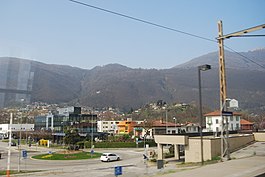
Lamone-Cadempino Train Station
|
||
|
||
| Coordinates: 46°2′N 8°56′E / 46.033°N 8.933°ECoordinates: 46°2′N 8°56′E / 46.033°N 8.933°E | ||
| Country | Switzerland | |
| Canton | Ticino | |
| District | Lugano | |
| Government | ||
| • Mayor | Sindaco | |
| Area | ||
| • Total | 0.76 km2 (0.29 sq mi) | |
| Elevation | 315 m (1,033 ft) | |
| Population (Dec 2015) | ||
| • Total | 1,529 | |
| • Density | 2,000/km2 (5,200/sq mi) | |
| Postal code | 6814 | |
| SFOS number | 5162 | |
| Surrounded by | Cureglia, Lamone, Manno, Vezia | |
| Website |
www SFSO statistics |
|
Cadempino is a municipality in the district of Lugano in the canton of Ticino in Switzerland.
Cadempino is first mentioned in 1004 as Cadampinus. Originally, it was owned by the Totoniden family of Campione d'Italia. In 844 their lands, including Cadempino, were given to the monastery of S. Ambrogio in Milan. By 1004, Como Cathedral and the Abbey of San Pietro in Ciel d'Oro in Pavia, also owned property in the village.
In the 14th Century the Church of SS Gervasio e Protasio was mentioned for the first time. It was part of the parish of Lamone in 1468 and in 1910 was raised to a Vicariate.
The grazing rights to the alpine meadows of Alp Traverno and Alp Guzzala were originally shared by Cadempino and Lamone. In 1507 Cadempino's rights were given to Isone. The shared grazing lands and disagreements over the border between Cadempino and Lamone led to a long-running disagreement. The two municipalities continued to fight over their mutual border until 1887.
Historically Cadempino was a farming community, with a little income from seasonal migrations and exploitation of sand pits. However, in the 20th century it changed as many industrial and commercial enterprises have settled in the municipality along the highway. The population has tripled since World War II, and is nearly one-third non-Swiss citizens. In 2001, a majority of workers (36 companies with 948 employees) worked in the industrial sector while the services sector had 75 companies but only 531 employees.
Cadempino has an area, as of 1997[update], of 0.76 square kilometers (0.29 sq mi). Of this area, 0.36 km2 (0.14 sq mi) or 47.4% is used for agricultural purposes, while 0.19 km2 (0.073 sq mi) or 25.0% is forested. Of the rest of the land, 0.44 km2 (0.17 sq mi) or 57.9% is settled (buildings or roads).
...
Wikipedia


