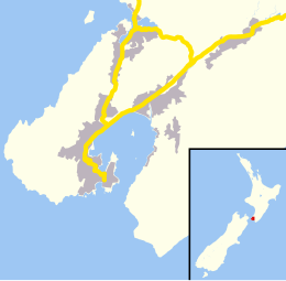
Mana Island, New Zealand
| Māori: Te Mana o Kupe | |
|---|---|
 |
|
| Geography | |
| Coordinates | 41°05′15″S 174°46′53″E / 41.0876°S 174.7815°E |
| Area | 2.17 km2 (0.84 sq mi) |
| Length | 3 km (1.9 mi) |
| Administration | |
Mana Island is the smaller of two islands that lie off the southwest coast of the North Island of New Zealand (the larger is Kapiti Island). The island’s name is an abbreviation of Te Mana o Kupe, "the mana of Kupe".
Mana Island is a 3 km (1.9 mi) long, 2.17 km2 (0.84 sq mi) table, with cliffs along much of its coast and a plateau occupying much of the interior. It lies 3 km (1.9 mi) off the North Island coast in the Tasman Sea, west of the city of Porirua and south of the entrance to Porirua Harbour. In 2009, it was selected by the Global Restoration Network as one of New Zealand's top 25 sites for ecological restoration.
Coordinates: 41°05′15″S 174°46′53″E / 41.0876°S 174.7815°E
Mana was established by Māori from the 14th century. In the early 1820s, the Ngati Toa iwi, led by Te Rauparaha established bases on Mana.
European occupation began 1830s with a whaling station, and bush was cleared for an early sheep farm. A lighthouse was built to the north in 1863, but shipwrecks were caused due to confusion between this light and Pencarrow light at the entrance to Wellington Harbour, and the Mana lighthouse was removed to Cape Egmont in Taranaki in 1877, where it still stands. It became Crown property in 1865 and was subsequently leased to J. F. E. Wright of Wellington.
...
Wikipedia

