Malawi
|
Republic of Malawi Dziko la Malaŵi
|
|||||
|---|---|---|---|---|---|
|
|||||
|
Motto: "Unity and Freedom"
|
|||||

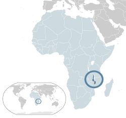
Location of Malawi (dark blue)
– in Africa (light blue & dark grey) |
|||||
| Capital and largest city |
Lilongwe 13°57′S 33°42′E / 13.950°S 33.700°E |
||||
| Official languages | English | ||||
| Recognised national languages | Chichewa | ||||
| Ethnic groups (2008) | |||||
| Demonym | Malawian | ||||
| Government | Unitary presidential republic | ||||
| Arthur Peter Mutharika | |||||
| Saulos Chilima | |||||
| Legislature | National Assembly | ||||
| Independence | |||||
|
• from the United Kingdom
|
6 July 1964 | ||||
|
• republic
|
6 July 1966 | ||||
|
• Current constitution
|
18 May 1994 | ||||
| Area | |||||
|
• Total
|
118,484 km2 (45,747 sq mi) (99th) | ||||
|
• Water (%)
|
20.6% | ||||
| Population | |||||
|
• 2013 estimate
|
|
||||
|
• 1998 census
|
9,933,868 | ||||
|
• Density
|
128.8/km2 (333.6/sq mi) (86th) | ||||
| GDP (PPP) | 2016 estimate | ||||
|
• Total
|
$21.843 billion | ||||
|
• Per capita
|
$1,172 | ||||
| GDP (nominal) | 2016 estimate | ||||
|
• Total
|
$6.149 billion | ||||
|
• Per capita
|
$330 | ||||
| Gini (2010) | 43.9 medium |
||||
| HDI (2013) |
low · 173rd |
||||
| Currency | Kwacha (D) (MWK) | ||||
| Time zone | CAT (UTC+2) | ||||
| Drives on the | left | ||||
| Calling code | +265 | ||||
| ISO 3166 code | MW | ||||
| Internet TLD | .mw | ||||
|
* Population estimates for this country explicitly take into account the effects of excess mortality due to AIDS; this can result in lower life expectancy, higher infant mortality and death rates, lower population and growth rates, and changes in the distribution of population by age and sex than would otherwise be expected.
|
|||||
Coordinates: 13°30′S 34°00′E / 13.500°S 34.000°E
– in Africa (light blue & dark grey)
– in the African Union (light blue)
Malawi (/məˈlɔːwi/, /məˈlɑːwi/ or /ˈmæləwi/; Chichewa: [maláβi] or [maláwi]), officially the Republic of Malawi, is a landlocked country in southeast Africa that was formerly known as Nyasaland. It is bordered by Zambia to the northwest, Tanzania to the northeast, and Mozambique on the east, south and west. The country is separated from Tanzania and Mozambique by Lake Malawi. Malawi is over 118,000 km2 (45,560 sq mi) with an estimated population of 16,777,547 (July 2013 est.). Its capital is Lilongwe, which is also Malawi's largest city; the second largest is Blantyre, the third is Mzuzu and the fourth largest is its old capital Zomba. The name Malawi comes from the Maravi, an old name of the Nyanja people that inhabit the area. The country is also nicknamed "The Warm Heart of Africa".
...
Wikipedia


