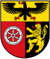
Mainz-Bingen (district)
| Mainz-Bingen | ||
|---|---|---|
| District | ||
|
||
 |
||
| Country |
|
|
| State | Rhineland-Palatinate | |
| Capital | Ingelheim | |
| Area | ||
| • Total | 605.85 km2 (233.92 sq mi) | |
| Population (31 December 2015) | ||
| • Total | 208,749 | |
| • Density | 340/km2 (890/sq mi) | |
| Time zone | CET (UTC+1) | |
| • Summer (DST) | CEST (UTC+2) | |
| Vehicle registration | MZ, BIN | |
| Website | mainz-bingen.de | |
Mainz-Bingen is a district (Kreis) in the east of Rhineland-Palatinate, Germany. Neighboring districts are (from north clockwise) Rheingau-Taunus, the district-free cities Wiesbaden and Mainz, the districts Groß-Gerau, Alzey-Worms, Bad Kreuznach, Rhein-Hunsrück.
During the French occupation under Napoleon the district was part of the departement Donnersberg (fr.:Mont-Tonnerre). After the Congress of Vienna, the area north of the Nahe river went to the Prussian Rhine province, the biggest part however became part of the Grand Duchy of Hesse and was called Rhenish Hesse. In 1835 the district Mainz was created, when the province Rheinhessen was abolished. In 1852 the district Oppenheim was created, and took some of the area of the Mainz district; in 1938 this district was abolished again. The district became the current borders in 1969, when the districts Mainz and Bingen were merged.
The main river in the district is the Rhine, which forms all the border of the district to the east. In Bingen the river Nahe enters the Rhine, after flowing a short part through the district. The flanks of the Hunsrück mountains in the west of the district to the Rhine valley are used as wine hills. The southern part of the district is part of the Rheinhessische Hügellandschaft, its gentle hills and the good climate make it a farming area for vegetables, especially asparagus.
...
Wikipedia

