Main Range National Park
|
Main Range National Park Queensland |
|
|---|---|
|
IUCN category II (national park)
|
|

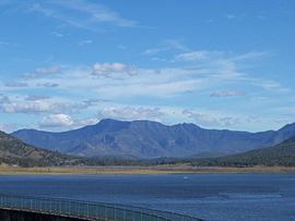
The forested slopes of Main Range to the south of Lake Moogerah.
|
|
| Nearest town or city | Warwick |
| Coordinates | 27°48′57″S 152°15′56″E / 27.81583°S 152.26556°ECoordinates: 27°48′57″S 152°15′56″E / 27.81583°S 152.26556°E |
| Established | 1965 |
| Area | 184 km2 (71.0 sq mi) |
| Managing authorities | Queensland Parks and Wildlife Service |
| Website | Main Range National Park |
| See also | Protected areas of Queensland |
The Main Range is a mountain range and a national park in Queensland, Australia, located predominantly in Tregony, Southern Downs Region 85 kilometres (53 mi) southwest of Brisbane. It is part of the World Heritage Site Gondwana Rainforests of Australia (formerly known as the Central Eastern Rainforest Reserves). It protects the western part of a semicircle of mountains in South East Queensland known as the Scenic Rim. This includes the largest area of rainforest in South East Queensland. The park is part of the Scenic Rim Important Bird Area, identified as such by BirdLife International because of its importance in the conservation of several species of threatened birds.
The park extends from Kangaroo Mountain south to Wilsons Peak on the New South Wales border and includes Mount Superbus (1,375 m), South East Queensland’s highest peak.
Bare Rock, Mount Cordeaux, Mount Mitchell, Spicers Peak, Mount Huntley, Mount Asplenium, Mount Steamer, The Steamer Range, Lizard Point, Mount Roberts, Mount Mistake and Mount Superbus all lie within the Main Range National Park. In total there are more than 40 peaks higher than 1,000 m.
...
Wikipedia

