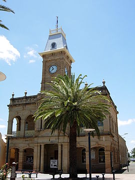
Warwick, Queensland
|
Warwick Queensland |
|||||||||||||
|---|---|---|---|---|---|---|---|---|---|---|---|---|---|

Town Hall
|
|||||||||||||
| Coordinates | 28°13′0″S 152°01′0″E / 28.21667°S 152.01667°ECoordinates: 28°13′0″S 152°01′0″E / 28.21667°S 152.01667°E | ||||||||||||
| Population | 15,505 (2015) | ||||||||||||
| Established | 1850 | ||||||||||||
| Postcode(s) | 4370 | ||||||||||||
| Elevation | 477 m (1,565 ft) | ||||||||||||
| Location |
|
||||||||||||
| LGA(s) | Southern Downs Region | ||||||||||||
| County | Merivale | ||||||||||||
| State electorate(s) | Southern Downs | ||||||||||||
| Federal Division(s) | Maranoa | ||||||||||||
|
|||||||||||||
|
|||||||||||||
Warwick /ˈwɒrɪk/ is a town and locality in southeast Queensland, Australia, lying 130 kilometres (81 mi) south-west of Brisbane. It is the administrative centre of the Southern Downs Region local government area. The surrounding Darling Downs have fostered a strong agricultural industry for which Warwick, together with the larger city of Toowoomba, serve as convenient service centres. The town had an estimated urban population of 15,505 at June 2015.
The Condamine River meanders from the east to the north-west of Warwick. One of its tributaries, Rosenthal Creek, enters Warwick from the south and enters the Condamine within Warwick.
The Cunningham Highway and the New England Highway jointly enter Warwick from the north, cross the Condamine River, and then turn west within the town close to the Warwick central business district. The Cunningham Highway then continues west towards Goondiwindi, while the New England Highway heads south towards Stanthorpe.
The Condamine River often floods, which can disconnect the northern and southern parts of Warwick and close the highways. Gauges that measure river height are used to provide flood alerts to residents. Low-lying land around the river is mostly used for recreation to minimise the damage caused by flooding with most developed areas at higher levels. Queens Park is a major park based around the river and the highway crossing.
The Warwick central business district is laid out on a grid pattern and lies within one or two blocks of the long main street, Palmerin Street with Grafton Street the major cross-street. The statue of former Queensland Premier Thomas Byrnes is located at their intersection.
...
Wikipedia

