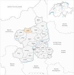
Mönthal
| Mönthal | ||
|---|---|---|
 |
||
|
||
| Coordinates: 47°31′N 8°8′E / 47.517°N 8.133°ECoordinates: 47°31′N 8°8′E / 47.517°N 8.133°E | ||
| Country | Switzerland | |
| Canton | Aargau | |
| District | Brugg | |
| Area | ||
| • Total | 3.93 km2 (1.52 sq mi) | |
| Elevation | 479 m (1,572 ft) | |
| Population (Dec 2015) | ||
| • Total | 391 | |
| • Density | 99/km2 (260/sq mi) | |
| Postal code | 5237 | |
| SFOS number | 4106 | |
| Surrounded by | Effingen, Elfingen, Gansingen, Oberbözberg, Remigen, Sulz | |
| Website |
www SFSO statistics |
|
Mönthal is a municipality in the district of Brugg in canton of Aargau in Switzerland.
Originally it was a fortified late Bronze Age hilltop settlement. Additionally, a Roman bronze figure was discovered in the village. During the High Middle Ages there were a number of small settlements in the area. Some of these houses still exist, while others (such as Bernbrunnen, which was mentioned as an independent village about 1300) have vanished. Mönthal is first mentioned about 1273 as Muenuntal. The low and high justice rights were held by the Habsburgs, until 1460 when they went to Bern. Under Bern it was part of the Schenkenberg bailiwick with the court in Stilli.
St. George's church was first mentioned in 1273. After 1380 the rights to the church collection and the appointment of the minister was held by Brugg. After 1860 Mönthal was an independent Reformed parish, though in 2007 it merged into the Bözberg parish.
Starting in 1630, the village had its own school, though the building dates from 1820.
Starting in the 18th Century the village had a certain prosperity through viticulture and home production of linen and cotton. However, starting in 1850, the population and economy decreased. It wasn't until 1970 that the population started to grow, though this was mostly commuters into the region of Baden-Brugg.
Mönthal has an area, as of 2009[update], of 3.93 square kilometers (1.52 sq mi). Of this area, 1.78 square kilometers (0.69 sq mi) or 45.3% is used for agricultural purposes, while 1.81 square kilometers (0.70 sq mi) or 46.1% is forested. Of the rest of the land, 0.34 square kilometers (0.13 sq mi) or 8.7% is settled (buildings or roads).
...
Wikipedia


