Elfingen
| Elfingen | ||
|---|---|---|
 |
||
|
||
| Coordinates: 47°31′N 8°6′E / 47.517°N 8.100°ECoordinates: 47°31′N 8°6′E / 47.517°N 8.100°E | ||
| Country | Switzerland | |
| Canton | Aargau | |
| District | Brugg | |
| Area | ||
| • Total | 4.23 km2 (1.63 sq mi) | |
| Elevation | 457 m (1,499 ft) | |
| Population (Dec 2015) | ||
| • Total | 279 | |
| • Density | 66/km2 (170/sq mi) | |
| Postal code | 5077 | |
| SFOS number | 4097 | |
| Surrounded by | Bözen, Effingen, Hornussen, Mönthal, Sulz | |
| Website |
www SFSO statistics |
|
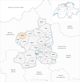
Elfingen is a municipality in the district of Brugg in canton of Aargau in Switzerland.
While Alamanni graves have been discovered in the municipality and it was the seat of a fief holder from Murbach Abbey in the 7th Century, Elfingen is first mentioned in 1245 as Eolfingen. When the Abbey sold their holdings in Aargau to the Habsburg in 1291, Elfingen was included. It came under the authority of Bern starting in 1460 and was part of the bailiwick Schenkenberg.
The Catholic parish church, was consecrated in 1323 to St. Leodegar. However the parish seat moved in the 16th Century to Bözen. The new parish included Bözen, Effingen, Zeihen (until 1528), Linn (to 1649) and Densbüren (1528–1642). The parsonage remained in Elfingen until 1824, when it moved to Bözen. By 1720 the village had its own school.
Until the 19th century agriculture (especially livestock) dominated the local economy. In the 18th century small-scale home spinning of cotton added to the local economy. In 2000, one quarter of the working population worked in the first sector of the economy.
Elfingen has an area, as of 2006[update], of 4.23 square kilometers (1.63 sq mi). Of this area, 1.94 square kilometers (0.75 sq mi) or 45.9% is used for agricultural purposes, while2.09 square kilometers (0.81 sq mi) or 49.4% is forested. Of the rest of the land, 0.16 square kilometers (0.062 sq mi) or 3.8% is settled (buildings or roads), 0.02 km2 (4.9 acres) or 0.5% is either rivers or lakes.
...
Wikipedia


