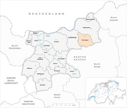
Gansingen
| Gansingen | ||
|---|---|---|
|
||
| Coordinates: 47°32′N 8°8′E / 47.533°N 8.133°ECoordinates: 47°32′N 8°8′E / 47.533°N 8.133°E | ||
| Country | Switzerland | |
| Canton | Aargau | |
| District | Laufenburg | |
| Area | ||
| • Total | 8.77 km2 (3.39 sq mi) | |
| Elevation | 382 m (1,253 ft) | |
| Population (Dec 2015) | ||
| • Total | 1,000 | |
| • Density | 110/km2 (300/sq mi) | |
| Postal code | 5272 | |
| SFOS number | 4164 | |
| Surrounded by | Hottwil, Mönthal, Oberhofen, Remigen, Sulz, Wil | |
| Twin towns | Gansheim (Germany) | |
| Website |
www SFSO statistics |
|
Gansingen is a municipality in the district of Laufenburg in the canton of Aargau in Switzerland.
While some Roman era artifacts have been discovered, the village of Gansingen is first mentioned in 1240 as Gansungen. Gansingen is located on the old road between the Rhine valley and the Aare valley over the Bürersteig. Between 1700-23 a number of Savoyards emigrated to Gansingen. Until the creation of the Helvetic Republic in 1797 it belonged to the court of Bernau in the Austrian herrschaft of Laufenburg. Then, with the Act of Mediation and the creation of the Canton of Aargau in 1803, it became part of the new Canton. In 1805, the pastor Johann Nepomuk Brentano built a girls' school in the village. In 1814, a fire raged through the village, and in 1829 the hamlet of Galten was destroyed by fire.
The parish church of St. George was first mentioned in 1240 and was replaced with a new building in the 19th century. Until 1802, the rights to appoint the parish priest and property rights to the land were held 1802 were in possession of the Collegiate church of Säckingen.
Because of crop failures in the mid-19th Century, the village population decreased after a wave of emigration. Until the 20th Century, the major economic sources in Gansingen were agriculture and light manufacturing. Today, many residents commute into the region of Baden-Brugg and the Rhine valley.
Gansingen has an area, as of 2009[update], of 8.77 square kilometers (3.39 sq mi). Of this area, 4.74 square kilometers (1.83 sq mi) or 54.0% is used for agricultural purposes, while 3.32 square kilometers (1.28 sq mi) or 37.9% is forested. Of the rest of the land, 0.68 square kilometers (0.26 sq mi) or 7.8% is settled (buildings or roads), 0.02 km2 (4.9 acres) or 0.2% is either rivers or lakes.
...
Wikipedia


