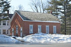
Lyndhurst, Ohio
| Lyndhurst, Ohio | |
|---|---|
| City | |

|
|
| Motto: "A Community of Neighbors" | |
 Location in Cuyahoga County and the state of Ohio. |
|
 Location of Ohio in the United States |
|
| Coordinates: 41°31′17″N 81°29′25″W / 41.52139°N 81.49028°WCoordinates: 41°31′17″N 81°29′25″W / 41.52139°N 81.49028°W | |
| Country | United States |
| State | Ohio |
| County | Cuyahoga |
| Government | |
| • Mayor | Patrick Ward |
| Area | |
| • Total | 4.44 sq mi (11.50 km2) |
| • Land | 4.43 sq mi (11.47 km2) |
| • Water | 0.01 sq mi (0.03 km2) |
| Elevation | 1,033 ft (315 m) |
| Population (2010) | |
| • Total | 14,001 |
| • Estimate (2012) | 13,821 |
| • Density | 3,160.5/sq mi (1,220.3/km2) |
| Time zone | Eastern (EST) (UTC-5) |
| • Summer (DST) | EDT (UTC-4) |
| ZIP code | 44124 |
| Area code(s) | 216, 440 |
| FIPS code | 39-45556 |
| GNIS feature ID | 1061453 |
| Website | http://www.lyndhurst-oh.com/ |
Lyndhurst is a city in Cuyahoga County, Ohio, United States, and an eastern suburb of Cleveland. The population was 14,001 at the 2010 census. A small part of Lyndhurst was originally part of Mayfield Township.
Lyndhurst is located at 41°31′17″N 81°29′25″W / 41.52139°N 81.49028°W (41.521352, -81.490141). It is bordered by South Euclid (with which it shares a school district), Richmond Heights, Highland Heights, Mayfield Heights, Pepper Pike, and Beachwood.
According to the United States Census Bureau, the city has a total area of 4.44 square miles (11.50 km2), of which 4.43 square miles (11.47 km2) is land and 0.01 square miles (0.03 km2) is water.
The land currently comprising Lyndhurst was part of the Western Reserve, obtained via treaty with the Iroquois tribe in 1796 by the Connecticut Land Company. In 1797, Moses Cleaveland named the area east of the Cuyahoga River Euclid, after the Greek Mathematician and Patron Saint of surveyors. Euclid Township was officially formed in 1809. Despite this, Lyndhurst’s population consisted mostly of Native American Indians until after the War of 1812.
...
Wikipedia
