Lower Tyrone Township, Fayette County, Pennsylvania
| Lower Tyrone Township | |
|---|---|
| Township | |

Linden Hall (1911)
National Register of Historic Places |
|
 Location of Lower Tyrone Township in Fayette County |
|
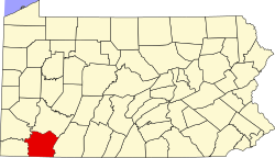
 Location of Fayette County in Pennsylvania |
|
| Country | United States |
| State | Pennsylvania |
| County | Fayette |
| Area | |
| • Total | 16.1 sq mi (41.8 km2) |
| • Land | 15.9 sq mi (41.1 km2) |
| • Water | 0.3 sq mi (0.7 km2) |
| Population (2010) | |
| • Total | 1,659 |
| • Estimate (2016) | 1,090 |
| • Density | 71/sq mi (27.3/km2) |
| Time zone | EST (UTC-4) |
| • Summer (DST) | EDT (UTC-5) |
| Area code(s) | 724 |
Lower Tyrone Township is a township in Fayette County, Pennsylvania, United States. The population was 1,123 at the 2010 census. It is the location of Linden Hall, an early 20th-century mansion and resort which is listed on the National Register of Historic Places. The Frazier School District serves the township.
Hulltown and Raineytown are unincorporated communities in the township.
It is named after County Tyrone, Northern Ireland.
The township is on the northern edge of Fayette County, bordered to the north by Westmoreland County. Jacobs Creek forms the northern township border and the county line, while the Youghiogheny River forms the southern township border. The borough of Dawson, a separate municipality, is on the southern edge of the township along the Youghiogheny.
Pennsylvania Route 819 crosses the township, leading northeast to Scottdale and south through Dawson and across the Youghiogheny to Vanderbilt.
According to the United States Census Bureau, Lower Tyrone Township has a total area of 16.1 square miles (41.8 km2), of which 15.9 square miles (41.1 km2) is land and 0.27 square miles (0.7 km2), or 1.57%, is water.
As of the census of 2000, there were 1,171 people, 461 households, and 342 families residing in the township. The population density was 73.9 people per square mile (28.5/km²). There were 480 housing units at an average density of 30.3/sq mi (11.7/km²). The racial makeup of the township was 99.40% White, 0.34% African American, 0.09% Native American, and 0.17% from two or more races. Hispanic or Latino of any race were 0.09% of the population.
...
Wikipedia
