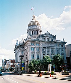
Westmoreland County, Pennsylvania
| Westmoreland County, Pennsylvania | |
|---|---|

|
|
 Location in the U.S. state of Pennsylvania |
|
 Pennsylvania's location in the U.S. |
|
| Founded | February 26, 1773 |
| Named for | Westmorland |
| Seat | Greensburg |
| Largest city | Murrysville |
| Area | |
| • Total | 1,036 sq mi (2,683 km2) |
| • Land | 1,028 sq mi (2,663 km2) |
| • Water | 8.5 sq mi (22 km2), 0.8% |
| Population (est.) | |
| • (2015) | 357,956 |
| • Density | 348/sq mi (134/km²) |
| Congressional districts | 9th, 12th, 14th, 18th |
| Time zone | Eastern: UTC-5/-4 |
| Website | www |
Westmoreland County is a county located in the U.S. state of Pennsylvania. At the 2010 census, the population was 365,169. The county seat is Greensburg. Cut from Lancaster, Northumberland, and later Bedford Counties, Westmoreland County was founded on February 26, 1773 and was the first county in the colony of Pennsylvania in which its entire territorial boundary was located west of the Allegheny Mountains. Westmoreland County originally included the present-day counties of Fayette, Washington, Greene, and parts of Beaver, Allegheny, Indiana, and Armstrong counties. It is named for Westmorland, a historic county of England.
Westmoreland County is included in the Pittsburgh, PA Metropolitan Statistical Area.
A major coal strike occurred in the county in the winter of 1910–11.
According to the U.S. Census Bureau, the county has a total area of 1,036 square miles (2,680 km2), of which 1,028 square miles (2,660 km2) is land and 8.5 square miles (22 km2) (0.8%) is water.
...
Wikipedia
