Little Falls, New Jersey
| Little Falls, New Jersey | |
|---|---|
| Township | |
| Township of Little Falls | |

Little Falls Town Hall
|
|
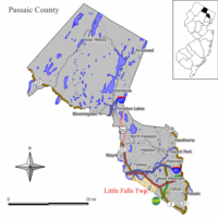
 Map of Little Falls Township in Passaic County. Inset: Location of Passaic County highlighted in the State of New Jersey. |
|
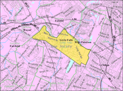
 Census Bureau map of Little Falls, New Jersey |
|
| Coordinates: 40°52′34″N 74°13′08″W / 40.876235°N 74.218886°WCoordinates: 40°52′34″N 74°13′08″W / 40.876235°N 74.218886°W | |
| Country |
|
| State |
|
| County | Passaic |
| Incorporated | April 2, 1868 |
| Government | |
| • Type | Faulkner Act (Mayor-Council) |
| • Body | Township Council |
| • Mayor | Darlene Conti (R, term ends December 31, 2016) |
| • Administrator | Charles Cuccia |
| • Clerk | Cynthia Kraus |
| Area | |
| • Total | 2.810 sq mi (7.277 km2) |
| • Land | 2.735 sq mi (7.084 km2) |
| • Water | 0.075 sq mi (0.193 km2) 2.65% |
| Area rank | 351st of 566 in state 14th of 16 in county |
| Elevation | 157 ft (48 m) |
| Population (2010 Census) | |
| • Total | 14,432 |
| • Estimate (2015) | 14,533 |
| • Rank | 175th of 566 in state 7th of 16 in county |
| • Density | 5,276.2/sq mi (2,037.2/km2) |
| • Density rank | 103rd of 566 in state 7th of 16 in county |
| Time zone | Eastern (EST) (UTC-5) |
| • Summer (DST) | Eastern (EDT) (UTC-4) |
| ZIP code | 07424 |
| Area code(s) | 973 |
| FIPS code | 3403140620 |
| GNIS feature ID | 0882313 |
| Website | www |
Little Falls is a township in Passaic County, New Jersey, United States. The township was named for a waterfall on the Passaic River at a dam near Beattie Mill.
As of the 2010 census, the township's population was 14,432, reflecting an increase of 3,577 (+33.0%) from the 10,855 counted in the 2000 Census, which had in turn declined by 439 (-3.9%) from the 11,294 counted in the 1990 Census.
Little Falls traces its first settlement to 1711 when seven Bergen Dutch settlers banded together to begin farming. The Speer Homestead dates from circa 1785 (and may have originally been built in 1680).
The Morris Canal, once an important artery of trade and transportation until 1925 between the Delaware and Hudson rivers, wound its way through the township and vestiges of it still remain., some parts of which are a greenway.
Little Falls was incorporated as a township by an act of the New Jersey Legislature on April 2, 1868, from portions of Acquackanonk Township. On March 25, 1914, portions of the township were taken to form the borough of West Paterson (now Woodland Park).
According to the United States Census Bureau, the township had a total area of 2.810 square miles (7.277 km2), including 2.735 square miles (7.084 km2) of land and 0.075 square miles (0.193 km2) of water (2.65%).
Singac (with a 2010 Census population of 3,618) is an unincorporated community and census-designated place (CDP) located within Little Falls Township.
...
Wikipedia
