Woodland Park, New Jersey
| Woodland Park, New Jersey | |
|---|---|
| Borough | |
| Borough of Woodland Park | |

Lambert Tower in Garret Mountain Reservation
|
|
 Map of Woodland Park in Passaic County (shown under its former name West Paterson). Inset: Location of Passaic County highlighted in the State of New Jersey. |
|
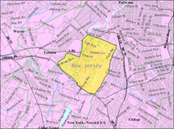
 Detailed Census Bureau map of West Paterson in 2000 |
|
| Coordinates: 40°53′24″N 74°11′40″W / 40.889908°N 74.194581°WCoordinates: 40°53′24″N 74°11′40″W / 40.889908°N 74.194581°W | |
| Country |
|
| State |
|
| County | Passaic |
| Incorporated | May 1, 1914 (as West Paterson) |
| Renamed | January 1, 2009 (to Woodland Park) |
| Government | |
| • Type | Faulkner Act (Small Municipality) |
| • Body | Borough Council |
| • Mayor | Keith Kazmark (D, term ends December 31, 2017) |
| • Administrator / Clerk | Kevin V. Galland |
| Area | |
| • Total | 3.115 sq mi (8.068 km2) |
| • Land | 2.964 sq mi (7.676 km2) |
| • Water | 0.151 sq mi (0.392 km2) 4.85% |
| Area rank | 329th of 566 in state 13th of 16 in county |
| Elevation | 348 ft (106 m) |
| Population (2010 Census) | |
| • Total | 11,819 |
| • Estimate (2015) | 12,518 |
| • Rank | 206th of 566 in state 9th of 16 in county |
| • Density | 3,987.9/sq mi (1,539.7/km2) |
| • Density rank | 152nd of 566 in state 8th of 16 in county |
| Time zone | Eastern (EST) (UTC-5) |
| • Summer (DST) | Eastern (EDT) (UTC-4) |
| ZIP code | 07424 |
| Area code(s) | 973 |
| FIPS code | 3403182423 |
| GNIS feature ID | 0885439 |
| Website | www |
Woodland Park (formerly West Paterson) is a borough in Passaic County, New Jersey, United States. As of the 2010 United States Census, the borough's population was 11,819, reflecting an increase of 832 (+7.6%) from the 10,987 counted in the 2000 Census, which had in turn increased by 5 (+0.0%) from the 10,982 counted in the 1990 Census.
What is now Woodland Park was formed as a borough under the name "West Paterson", by an act of the New Jersey Legislature on March 25, 1914, from portions of Little Falls Township, based on the results of a referendum held on May 1, 1914.
On November 4, 2008, the citizens of West Paterson voted to change the official name of the borough from West Paterson to Woodland Park. The new name retains the initials "W.P." and is a reference to the community's wooded areas. At a November 10, 2008, community meeting attended by 200 residents, a number of residents demanded that a recount be held if the official results showed that the measure had passed. In case the recount demand was unsuccessful, the group discussed filing a petition to change the name back to West Paterson, including discussion of how to raise the $33,000 needed to cover the cost of a special election in spring 2009 for voters to reconsider the name. By November 25, 2008, the provisional vote counts had been tallied, and the name change won by 25 votes. The Mayor and Council approved a resolution in December 2008, officially changing the borough's name to the Borough of Woodland Park, effective January 1, 2009. A referendum held on November 3, 2009, affirmed the name change.
According to the United States Census Bureau, the borough had a total area of 3.115 square miles (8.068 km2), including 2.964 square miles (7.676 km2) of land and 0.151 square miles (0.392 km2) of water (4.85%).
Slippery Rock Brook is a tributary of the Passaic River that flows north as it drains part of the western flank of First Watchung Mountain. Traveling south from its confluence with the Passaic River, it passes through the city of Paterson and the borough of Woodland Park.
...
Wikipedia
