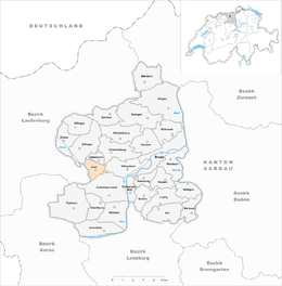
Linn, Switzerland
| Linn | ||
|---|---|---|
| Former municipality of Switzerland | ||

Linn village
|
||
|
||
| Coordinates: 47°28′N 8°8′E / 47.467°N 8.133°ECoordinates: 47°28′N 8°8′E / 47.467°N 8.133°E | ||
| Country | Switzerland | |
| Canton | Aargau | |
| District | Brugg | |
| Area | ||
| • Total | 2.55 km2 (0.98 sq mi) | |
| Elevation | 570 m (1,870 ft) | |
| Population (Dec 2011) | ||
| • Total | 136 | |
| • Density | 53/km2 (140/sq mi) | |
| Postal code | 5225 | |
| SFOS number | 4103 | |
| Surrounded by | Effingen, Gallenkirch, Schinznach-Dorf, Unterbözberg, Villnachern, Zeihen | |
| Website | SFSO statistics |
|
Linn is a former municipality in the district of Brugg in canton of Aargau in Switzerland. On 1 January 2013 the former municipalities of Gallenkirch, Linn, Oberbözberg and Unterbözberg merged to form the new municipality of Bözberg.
Linn is first mentioned around 1303-08 as ze Linne. In 1307 it was mentioned as ze Lind. The name is probably connected with the 500- to 800-year-old, legendary Linden tree which is east of Linn. In the Middle Ages it probably belonged to the vogtei of Elfingen. In 1460 it was incorporated as part of the court of Bözberg in the Canton of Bern.
Initially, its inhabitants were part of the Elfingen-Bözen parish, and after 1649 the Bözberg parish. Before the Reformation in 1528, it possessed a chapel.
Agriculture was the major economic activity up into the middle of the 19th century. Due to declining opportunities in the mid-19th century, many of the farming families migrated away. By the end of the 20th century there were seven farms, while most other workers in the region were working in Brugg. Since the 1990s, Linn has been accessible by Postauto.
Linn had an area, as of 2009[update], of 2.55 square kilometers (0.98 sq mi). Of this area, 1.29 square kilometers (0.50 sq mi) or 50.6% is used for agricultural purposes, while 1.13 square kilometers (0.44 sq mi) or 44.3% is forested. Of the rest of the land, 0.12 km2 (30 acres) or 4.7% is settled (buildings or roads). Of the built up area, housing and buildings made up 3.1% and transportation infrastructure made up 1.6%. 42.4% of the total land area is heavily forested and 2.0% is covered with orchards or small clusters of trees. Of the agricultural land, 23.1% is used for growing crops and 25.5% is pastures, while 2.0% is used for orchards or vine crops.
...
Wikipedia


