Gallenkirch
| Gallenkirch | ||
|---|---|---|
| Former municipality of Switzerland | ||
|
||
| Coordinates: 47°29′N 8°8′E / 47.483°N 8.133°ECoordinates: 47°29′N 8°8′E / 47.483°N 8.133°E | ||
| Country | Switzerland | |
| Canton | Aargau | |
| District | Brugg | |
| Area | ||
| • Total | 1.4 km2 (0.5 sq mi) | |
| Elevation | 565 m (1,854 ft) | |
| Population (Dec 2011) | ||
| • Total | 133 | |
| • Density | 95/km2 (250/sq mi) | |
| Postal code | 5224 | |
| SFOS number | 4098 | |
| Surrounded by | Effingen, Linn, Unterbözberg | |
| Website |
www SFSO statistics |
|
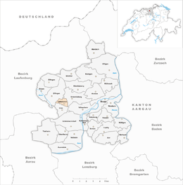
Gallenkirch is a former municipality in the district of Brugg in canton of Aargau in Switzerland. On 1 January 2013 the former municipalities of Gallenkirch, Linn, Oberbözberg and Unterbözberg merged to form the new municipality of Bözberg.
Gallenkirch is first mentioned in 1338 as Gallenkilch. During the Middle Ages, Gallenkirch was part of the district of Hornussen under the city of Bad Säckingen. Religiously, until the Reformation the residents were also part of the parish of Hornussen. The local chapel was dedicated to Saint Gall, but is no longer standing. Portions of the structure were incorporated into a later building. After the Reformation the village became part of the reformed parish of Bözberg. Under Bernese rule (1460-1798) the village was part of the Thalheim court. In the 19th and 20th century, several attempts to merge Gallenkirch into the village of Linn failed. However, since 1917, children attend the local school in Linn, and other infrastructure problems are solved through inter-municipal cooperation. In Gallenkirch there is no shopping or other economy. Today's inhabitants are farmers or commuters to the nearby industrial centers.
Gallenkirch had an area, as of 2009[update], of 1.4 square kilometers (0.54 sq mi). Of this area, 1.04 square kilometers (0.40 sq mi) or 74.3% is used for agricultural purposes, while 0.26 square kilometers (0.10 sq mi) or 18.6% is forested. Of the rest of the land, 0.1 km2 (25 acres) or 7.1% is settled (buildings or roads).
...
Wikipedia


