Lingewaal
| Lingewaal | |
|---|---|
| Municipality | |

Former windmill in Herwijnen
|
|
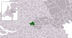
 Location in Gelderland |
|
| Coordinates: 51°53′N 5°7′E / 51.883°N 5.117°ECoordinates: 51°53′N 5°7′E / 51.883°N 5.117°E | |
| Country | Netherlands |
| Province | Gelderland |
| Established | 1 January 1986 |
| Government | |
| • Body | Municipal council |
| • Mayor | Loes van Ruijven-van Leeuwen (CDA) |
| Area | |
| • Total | 54.49 km2 (21.04 sq mi) |
| • Land | 50.44 km2 (19.47 sq mi) |
| • Water | 4.05 km2 (1.56 sq mi) |
| Elevation | 2 m (7 ft) |
| Population (May 2014) | |
| • Total | 11,033 |
| • Density | 219/km2 (570/sq mi) |
| Time zone | CET (UTC+1) |
| • Summer (DST) | CEST (UTC+2) |
| Postcode | Parts of 4100 and 4200 ranges |
| Area code | 0183, 0345, 0418 |
| Website | www |
Lingewaal (![]() pronunciation ) is a municipality of the Netherlands.
pronunciation ) is a municipality of the Netherlands.
Dutch topographic map of the municipality of Lingewaal, June 2015
...
Wikipedia

