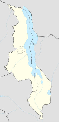
Lilongwe, Malawi
| Lilongwe | |
|---|---|
  
Parliament of Malawi, King's African Rifles War Memorial, Old Town
|
|
| Location of Lilongwe | |
| Coordinates: 13°59′S 33°47′E / 13.983°S 33.783°ECoordinates: 13°59′S 33°47′E / 13.983°S 33.783°E | |
| Country |
|
| Region | Central Region |
| District | Lilongwe |
| Government | |
| • Mayor | Willie Chipondera |
| Elevation | 1,050 m (3,440 ft) |
| Population (2015)National Statistical Office of Malawi | |
| • Total | 1,077,116 |
| • Density | 1,479/km2 (3,830/sq mi) |
| Time zone | CAT (UTC+2) |
| Climate | Cwa |
| Website | www.llcitycouncil.org/ |
Lilongwe (UK pronunciation: /lɪˈlɒŋ.weɪ/; US pronunciation: /lɪˈlɔːŋ.weɪ/ or /lɪˈlɑːŋ.weɪ/) is the largest and capital city of Malawi with an estimated population of 1,077,116 for 2015. The city is located in the central region of Malawi, near the borders with Mozambique and Zambia, and it is an important economic and transportation hub for central Malawi. It is named after the Lilongwe River.
Lilongwe had existed for centuries as a small fishing village on the banks of the Lilongwe River. During British Colonial Rule, the settlement became an administrative centre due to its strategic location. Formally founded in 1906 as a trading post, Lilongwe was officially recognised as a town in 1947. After gaining independence, it increasingly developed into an important trading centre in Malawi's central region. Its growth was encouraged when the country's former head of state, Hastings Kamuzu Banda, established it as Malawi's new capital city in 1975. The last government offices were relocated to Lilongwe in 2005. The city's population is increasing rapidly, with an annual growth rate of 4.3%.
...
Wikipedia

