Lemland
| Lemland | ||
|---|---|---|
| Municipality | ||
| Lemlands kommun | ||

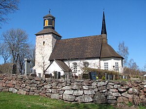
The medieval parish church in Lemland.
|
||
|
||
 Location of Lemland in Finland |
||
| Location in Åland | ||
| Coordinates: 60°04.2′N 020°05.2′E / 60.0700°N 20.0867°ECoordinates: 60°04.2′N 020°05.2′E / 60.0700°N 20.0867°E | ||
| Country |
|
|
| Region | Åland | |
| Sub-region | Åland Countryside sub-region | |
| Government | ||
| • Municipal manager | Mikael Smeds | |
| Area (2016-01-01) | ||
| • Total | 113.23 km2 (43.72 sq mi) | |
| • Land | 113.08 km2 (43.66 sq mi) | |
| • Water | 852.23 km2 (329.05 sq mi) | |
| Area rank | 293rd largest in Finland | |
| Population (2016-03-31) | ||
| • Total | 1,991 | |
| • Rank | 270th largest in Finland | |
| • Density | 17.61/km2 (45.6/sq mi) | |
| Population by native language | ||
| • Swedish | 93.2% (official) | |
| • Finnish | 4.4% | |
| • Others | 2.4% | |
| Population by age | ||
| • 0 to 14 | 21.9% | |
| • 15 to 64 | 64.3% | |
| • 65 or older | 13.8% | |
| Time zone | EET (UTC+2) | |
| • Summer (DST) | EEST (UTC+3) | |
| Municipal tax rate | 16.5% | |
| Website | www.lemland.ax | |
Lemland is a municipality of Åland, an autonomous territory of Finland.
The municipality has a population of 1,991 (31 March 2016) and covers an area of 113.23 square kilometres (43.72 sq mi) of which 852.23 km2 (329.05 sq mi) is water. The population density is 17.61 inhabitants per square kilometre (45.6/sq mi).
The municipality is unilingually Swedish.
The church in Lemland was built in the 13th century and has wall paintings from the 14th century. The church is dedicated to Bridget of Sweden.
During the Finnish War in 1808 the Swedish king Gustav IV Adolf had his headquarters in the Lemland parsonage.
...
Wikipedia


