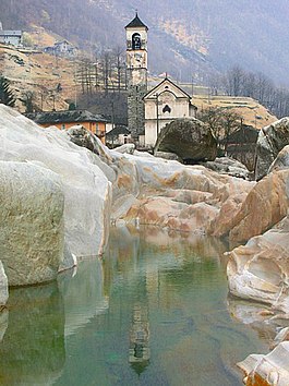
Lavertezzo
| Lavertezzo | ||
|---|---|---|
 |
||
|
||
| Coordinates: 46°15′N 8°50′E / 46.250°N 8.833°ECoordinates: 46°15′N 8°50′E / 46.250°N 8.833°E | ||
| Country | Switzerland | |
| Canton | Ticino | |
| District | Locarno | |
| Government | ||
| • Mayor | Sindaco | |
| Area | ||
| • Total | 58.11 km2 (22.44 sq mi) | |
| Elevation | 536 m (1,759 ft) | |
| Population (Dec 2015) | ||
| • Total | 1,343 | |
| • Density | 23/km2 (60/sq mi) | |
| Postal code | 6595 | |
| SFOS number | 5112 | |
| Surrounded by | Brione (Verzasca), Corippo, Cugnasco, Frasco, Gerra (Verzasca), Gordevio, Gordola, Iragna, Locarno, Lodrino, Personico, Preonzo, Vogorno | |
| Website |
www SFSO statistics |
|
Lavertezzo is a municipality in the district of Locarno in the canton of Ticino in Switzerland.
Lavertezzo is first mentioned in 1327 as Laverteze. In the Middle Ages, Lavertezzo was a Squadra of the Vicinanza of Verzasca. For centuries the people lived, in the summer months, in the Verzasca valley and migrated in the winter, with their cattle, to the lower valleys. After the dissolution of Terricciole in 1920, a shared territory between Locarno, Minusio and Mergoscia, the settlement of Riazzino was allocated to Lavertezzo.
The parish church of Madonna degli Angeli was built in the 18th Century. Lavertezzo became an independent parish in the 16th century, when it separated from Vogorno. It was granted a provost in 1806.
The double arch stone bridge was built in the 17th century, and is one of the most distinctive sights in the village. The economy in the valley consisted mainly of farming and grazing. There was added income, from emigrants who went to Italy, especially Palermo. In 1873, they began to systematically produce granite from quarries in Lavertezzo. In the last decades of the 20th century Riazzino developed into a shopping and recreation center. By 2000, the agricultural sector still provided a good one-tenth of the jobs in Lavertezzo.
Lavertezzo has an area, as of 1997[update], of 58.11 square kilometers (22.44 sq mi). Of this area, 0.7 km2 (0.27 sq mi) or 1.2% is used for agricultural purposes, while 29.34 km2 (11.33 sq mi) or 50.5% is forested. Of the rest of the land, 0.52 km2 (0.20 sq mi) or 0.9% is settled (buildings or roads), 0.96 km2 (0.37 sq mi) or 1.7% is either rivers or lakes and 22.83 km2 (8.81 sq mi) or 39.3% is unproductive land.
...
Wikipedia


