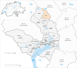
Frasco
| Frasco | ||
|---|---|---|

Frasco village
|
||
|
||
| Coordinates: 46°20′N 8°48′E / 46.333°N 8.800°ECoordinates: 46°20′N 8°48′E / 46.333°N 8.800°E | ||
| Country | Switzerland | |
| Canton | Ticino | |
| District | Locarno | |
| Government | ||
| • Mayor | Sindaco | |
| Area | ||
| • Total | 25.72 km2 (9.93 sq mi) | |
| Elevation | 885 m (2,904 ft) | |
| Population (Dec 2015) | ||
| • Total | 100 | |
| • Density | 3.9/km2 (10/sq mi) | |
| Postal code | 6636 | |
| SFOS number | 5105 | |
| Surrounded by | Chironico, Gerra (Verzasca), Giornico, Lavertezzo, Personico, Sonogno | |
| Website |
www SFSO statistics |
|
Frasco is a municipality in the district of Locarno in the canton of Ticino in Switzerland.
Frasco is first mentioned in 1235 as Felasco. During the Middle Ages, Frasco was part of the greater Vicinanza of Verzasca. In 1395, it and Sonogno formed a single political municipality, which existed until 1843. The village church of St. Bernhard was probably built in the 14th Century. The present church dates from 1868–69 and stands on the foundations of the old building. In 1518 Frasco and Sonogno separated from the parish of Vogorno and formed their own parish, which lasted until it divided again in 1734. For centuries, the inhabitants lived on agriculture and alpine seasonal migrations with livestock. Starting in 1870, the Val d'Efra, a vein of white marble, was exploited for limestone quarries. In 2000, the agricultural sector was the only sector providing jobs in Frasco, while about two-thirds of the workers were commuters. In the hamlet of Piede della Motta, there are frescoes from the 15th Century. All of the old settlement areas of the municipality are now protected as historical buildings. More recently, however, many houses have been built in the municipality.
Frasco has an area, as of 1997[update], of 25.72 square kilometers (9.93 sq mi). Of this area, 0.45 km2 (0.17 sq mi) or 1.7% is used for agricultural purposes, while 11.14 km2 (4.30 sq mi) or 43.3% is forested. Of the rest of the land, 0.22 km2 (0.085 sq mi) or 0.9% is settled (buildings or roads), 0.48 km2 (0.19 sq mi) or 1.9% is either rivers or lakes and 12.09 km2 (4.67 sq mi) or 47.0% is unproductive land.
Of the built up area, housing and buildings made up 0.4% and transportation infrastructure made up 0.3%. Out of the forested land, 27.4% of the total land area is heavily forested, while 11.7% is covered in small trees and shrubbery and 4.1% is covered with orchards or small clusters of trees. Of the agricultural land, 1.3% is used for growing crops. All the water in the municipality is flowing water. Of the unproductive areas, 24.3% is unproductive vegetation and 22.7% is too rocky for vegetation.
...
Wikipedia


