Lake Goycha
| Lake Sevan | |
|---|---|

Aerial view of the lake
|
|

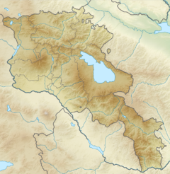
Lake Sevan is located in central eastern Armenia
|
|
| Location | Gegharkunik Province, Armenia |
| Coordinates | 40°19′N 45°21′E / 40.317°N 45.350°ECoordinates: 40°19′N 45°21′E / 40.317°N 45.350°E |
| Primary inflows | 28 rivers and streams |
| Primary outflows | evaporation: 85–90%, Hrazdan River: 10-15% |
| Basin countries | Armenia |
| Managing agency | Ministry of Nature Protection |
| Max. length | 74 km (46 mi) |
| Max. width | 32 km (20 mi) |
| Surface area | 1,242 km2 (480 sq mi) (2009) |
| Average depth | 25.9 m (85 ft) (2009) |
| Max. depth | 79.4 m (260 ft) (2009) |
| Water volume | 32.8 km3 (26,600,000 acre·ft) (2009) |
| Salinity | 0.7% |
| Surface elevation | 1,900.19 m (6,234.2 ft) (2012) |
| Islands | formerly 1 (now a peninsula) |
| Sections/sub-basins | 2 (Major Sevan, Minor Sevan) |
| Settlements | Gavar, Sevan, Martuni, Vardenis |
| Designations | |
|---|---|
|
IUCN Category II (National Park)
|
|
| Official name | Sevan National Park |
| Designated | 14 March 1978 |
| Designated | 6 July 1993 |
Lake Sevan (Armenian: Սևանա լիճ, Sevana lič̣) is the largest body of water in Armenia and the Caucasus region, and one of the largest freshwater high-altitude lakes in Eurasia. The lake is situated in Gegharkunik Province, at an altitude of 1,900 m (6,234 ft) above sea level. The total surface area of its basin is about 5,000 km2 (1,900 sq mi), which makes up 1⁄6 of Armenia's territory. The lake itself is 1,242 km2 (480 sq mi), and the volume is 32.8 km3 (7.9 cu mi). It is fed by 28 rivers and streams. Only 10% of the incoming water is drained by the Hrazdan River, while the remaining 90% evaporates.
Sevan provides some 90% of the fish and 80% of the crayfish catch of Armenia. It has significant economic, cultural, and recreational value. Its only island (now a peninsula) is home to a medieval monastery.
Sevan was heavily exploited for irrigation of the Ararat plain and hydroelectric power generation during the Soviet period. Consequently, its water level decreased by around 20 m (66 ft) and its volume reduced by more than 40%. Two underground tunnels were later built to divert water from highland rivers, which halted its decline and its level began rising. Before human intervention dramatically changed the lake's ecosystem, the lake was 95 m (312 ft) deep, covered an area of 1,416 km2 (547 sq mi) (5% of Armenia's entire area), and had a volume of 58.5 km3 (14.0 cu mi). The lake's surface was at an altitude of 1,916 m (6,286 ft) above sea level.
"Sevan" is thought by scholars to have originated from the Urartian word suinia or suinna or sunia, which means "lake". The term is found on an 8th-century BC inscription by the Urartian king Rusa I, found in Odzaberd, in the southern shore on the lake.
There are at least two popular versions of origins of the word "Sevan". According to one, Sevan comes from the Armenian words sev (black) and vank’ (monastery), referring to the island monastery. The second version links Sevan's name with that of Lake Van. It is said that long ago, Armenians came from the areas around Lake Van to Lake Sevan. They saw that the lake was dark and almost black yet reminded them of Van, therefore the lake was called sev ("black") + Van.
...
Wikipedia
