Kreuzberg (Tempelhofer Berge)
| Kreuzberg | |
|---|---|

The Kreuzberg, seen from northwest in 1886, painting by Otto Piltz
|
|
| Highest point | |
| Elevation | 66 m (217 ft) |
| Coordinates | 52°29′15″N 13°22′53″E / 52.48750°N 13.38139°ECoordinates: 52°29′15″N 13°22′53″E / 52.48750°N 13.38139°E |
| Naming | |
| Translation | Cross mountain (German) |
| Geography | |
| Location | Berlin, Germany |
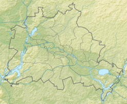
The Kreuzberg (German for Cross Mountain) is a hill in the Kreuzberg locality of Berlin, Germany, in former West Berlin. It rises about 66 m (217 ft) above the sea level. It was named by King Frederick William III of Prussia after the Iron Cross which crowns the top of the Prussian National Monument for the Liberation Wars, designed by Karl Friedrich Schinkel, on its inauguration on 30 March 1821. On 27 September 1921 the borough assembly of the VIth borough of Berlin decided to name the borough after the hill. The borough was subsequently downgraded to a locality in 2001,
Former names of the Kreuzberg were Sandberg (sand mountain), Runder Berg (1524) or Runder Weinberg (Round Mountain or Round Wine Mountain/Vineyard), Tempelhofer Berg and corrupted Templower Berg (both Tempelhof Mountain), Götzens Berg (1798) or Götzescher Berg (1818; both Götze's Mountain), Kreutzberg (1822, 1834) and Kreuzberg (1856). Since the 1850s the hill was also nicknamed Monte Cruce or Monte Croce.
The Kreuzberg is a natural hill and forms part of the Tempelhofer Berge range (Tempelhof hills) stretching along the northern descent of the Teltow Plateau between Schöneberg and the Rollberge in Neukölln. It rises about 66 m (217 ft) above the sea level and 32 m (105 ft) above the northerly adjacent Berlin-Warsaw glacial valley. The Teltow Plateau is a flatly undulating ground moraine landscape. The Kreuzberg's relatively steep northern slope derives from the erosion by meltwater running into the Berlin-Warsaw glacial valley, when it was formed by the Weichselian glaciation. The Berlin-Warsaw glacial valley stretches to 5 km (3.1 mi) between the southern Kreuzberg and the northern Prenzlauer Berg, thus forming here the narrowest point between the northerly Barnim Plateau and southern Teltow Plateau.
...
Wikipedia

