Neukölln
| Neukölln | ||
|---|---|---|
| Borough of Berlin | ||
|
||
| Coordinates: 52°29′N 13°27′E / 52.483°N 13.450°ECoordinates: 52°29′N 13°27′E / 52.483°N 13.450°E | ||
| Country | Germany | |
| State | Berlin | |
| City | Berlin | |
| Government | ||
| • Mayor | Franziska Giffey (SPD) | |
| Area | ||
| • Total | 44.93 km2 (17.35 sq mi) | |
| Population (2012-11-30) | ||
| • Total | 322,931 | |
| • Density | 7,200/km2 (19,000/sq mi) | |
| Time zone | CET/CEST (UTC+1/+2) | |
| Vehicle registration | B | |
| Website | Official homepage | |
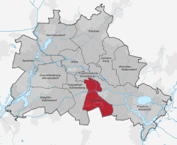
Neukölln is the eighth borough of Berlin, located in the southeastern part of the city and was part of the former American sector under the Four-Power occupation of the city. It features many Gründerzeit buildings and is characterized by having one of the highest percentage of immigrants in Berlin.
Neukölln's independence ended in 1920 when it was incorporated into Berlin. See History of Neukölln (locality/Stadtteil Berlins)
From 1966 to 1975 the Gropiusstadt was built, a "Trabantenstadt" or city-within-a-city housing estate, designed by architect Walter Gropius.
Neukölln is selected as pilot city of the Council of Europe and the European Commission Intercultural cities programme.
As of 2010, the borough had a population of 310,283, of whom 121,000 (~40%) were of non-German ethnicity/origin. The percentage is significantly higher in the same-named locality of Neukölln. The borough is known for its large Turkish, Arab and Kurdish communities, which together make up roughly 18% of the borough's population. Recently, there has been an influx of Romani people and Sub-Saharan Africans. Another noticeable trend is the rapid gentrification of certain neighborhoods within the borough, where the influx of students, creatives and other young professionals of mostly Western origin has caused some tension.
...
Wikipedia


