Khairagarh State
| Khairagarh State खैरागढ़ रियासत |
|||||
| Princely State of British India | |||||
|
|||||
|
Flag |
|||||
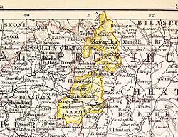
| Khairagarh State in the Imperial Gazetteer of India | |||||
| History | |||||
| • | Established | 1833 | |||
| • | Accession to the Indian Union | 1948 | |||
| Area | |||||
| • | 1931 | 1,033 km2(399 sq mi) | |||
| Population | |||||
| • | 1931 | 157,400 | |||
| Density | 152.4 /km2 (394.6 /sq mi) | ||||
| Today part of | Rajnandgaon district, Chhattisgarh | ||||
Flag
Khairagarh State (Hindi: खैरागढ़) was one of the princely states of India during the period of the British Raj. Khairagarh town in Rajnandgaon District of Chhattisgarh was the capital of the state and the see of the Raja's residence.
Khairagarh estate was founded in 1833. In 1898 Khairagarh estate was recognized as a state. Most of the inhabitants of the state were Gonds, Lodhis, Chamars and Ahirs distributed in 497 small villages besides the main town. The rulers were Rajputs of the Nagavamshi dynasty. Khairagarh State's last ruler signed the accession to the Indian Union on 1 January 1948.
The rulers of the princely state of Khairagarh bore the title of 'Raja'.
Coordinates: 21°25′N 80°58′E / 21.42°N 80.97°E
...
Wikipedia


