Kerava
| Kerava | ||
|---|---|---|
| Town | ||
| Keravan kaupunki | ||

Kerava town centre
|
||
|
||
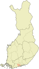
 Location of Kerava in Finland |
||
| Coordinates: 60°24′N 025°06′E / 60.400°N 25.100°ECoordinates: 60°24′N 025°06′E / 60.400°N 25.100°E | ||
| Country |
|
|
| Region | Uusimaa | |
| Sub-region | Helsinki sub-region | |
| Charter | 1970 | |
| Government | ||
| • Town manager | Kirsi Rontu | |
| Area (2016-01-01) | ||
| • Total | 30.63 km2 (11.83 sq mi) | |
| • Land | 30.62 km2 (11.82 sq mi) | |
| • Water | 0.17 km2 (0.07 sq mi) | |
| Area rank | 309th largest in Finland | |
| Population (2016-03-31) | ||
| • Total | 35,251 | |
| • Rank | 32nd largest in Finland | |
| • Density | 1,151.24/km2 (2,981.7/sq mi) | |
| Population by native language | ||
| • Finnish | 94.8% (official) | |
| • Swedish | 1.1% | |
| • Others | 4.1% | |
| Population by age | ||
| • 0 to 14 | 17.7% | |
| • 15 to 64 | 70.3% | |
| • 65 or older | 12% | |
| Time zone | EET (UTC+2) | |
| • Summer (DST) | EEST (UTC+3) | |
| Municipal tax rate | 18.75% | |
| Climate | Dfb | |
| Website | www.kerava.fi | |
Kerava (Finnish pronunciation: [ˈkerɑʋɑ]; Swedish: Kervo) is a town and municipality in Finland.
It is located in the province of Southern Finland and is part of the Uusimaa region. The town has a population of 35,251 (31 March 2016) and covers an area of 30.63 square kilometres (11.83 sq mi) of which 0.17 km2 (0.066 sq mi) is water. The population density is 1,151.24 inhabitants per square kilometre (2,981.7/sq mi). The municipality is unilingually Finnish.
Kerava railway station is an interchange (transfer) station, with connections from the main track from Helsinki to Riihimäki to the tracks to Lahti and Sköldvik/Porvoo. Helsinki Airport is located about 12 km to the southwest of the city.
Results of the Finnish parliamentary election, 2011 in Kerava:
...
Wikipedia

