Kazi Magomed
| Hajiqabul | |
|---|---|
| City & Municipality | |
 |
|
| Coordinates: 40°02′36″N 48°56′08″E / 40.04333°N 48.93556°ECoordinates: 40°02′36″N 48°56′08″E / 40.04333°N 48.93556°E | |
| Country |
|
| Rayon | Hajigabul |
| Population | |
| • Total | 23,512 |
| Time zone | AZT (UTC+4) |
| • Summer (DST) | AZT (UTC+5) |
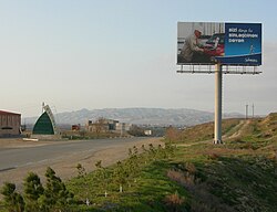
Hajiqabul (also known as Hajigabul and Adzhikabul) is a town and municipality in and the capital of Hajigabul District of Azerbaijan. It has a population of 23,512. The municipality consists of the city of Qazıməmməd and the village of Balıqçı.
It was named after a nearby eponymous lake; the name literally means bitter lake in Azerbaijani. It was granted urban-type settlement status in 1934 and town status in 1938. In 1939, the town was renamed Kazi-Magomed (alternatively spelled Qaziməmməd and Qazıməmməd), after revolutionary Kazi Magomed Agasiyev. The original name was restored in 2000.
Hajiqabul sits on one of the Azerbaijani primary rail lines running East-West connecting the capital, Baku, with the rest of the country. The Kars–Tbilisi–Baku railway will run along the line through the city. The railway provides both human transportation and transport of goods and commodities such as oil and gravel.
Hajiqabul's Central Railway Station is the terminus for national and international rail links to the city. The construction of the Kars–Tbilisi–Baku railway, which will directly connect Turkey, Georgia, and Azerbaijan, began in 2007 and is scheduled for completion in 2015. The completed branch will connect the city with Tbilisi in Georgia, and from there trains will continue to Akhalkalaki, and Kars in Turkey.
...
Wikipedia

