Kauai County
| Kauai County, Hawaii | ||
|---|---|---|
|
||
 Location in the U.S. state of Hawaii |
||
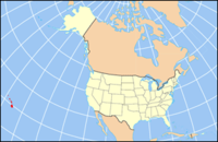
 Hawaii's location in the U.S. |
||
| Founded | 1905 | |
| Seat | Lihue | |
| Largest community | Kapa‘a | |
| Area | ||
| • Total | 1,266 sq mi (3,279 km2) | |
| • Land | 620 sq mi (1,606 km2) | |
| • Water | 646 sq mi (1,673 km2), 51.0% | |
| Population (est.) | ||
| • (2015) | 71,735 | |
| • Density | 108/sq mi (42/km²) | |
| Congressional district | 2nd | |
| Time zone | Hawaii-Aleutian: UTC-10 | |
| Website | www |
|
Kauaʻi County is a county located in the U.S. state of Hawaiʻi. It consists of the islands of Kauaʻi, Niʻihau, Lehua, and Kaʻula. As of the 2010 Census the population was 67,091. The county seat is Līhuʻe.
The Kapa'a Micropolitan Statistical Area includes all of Kauai County.
According to the U.S. Census Bureau, the county has a total area of 1,266 square miles (3,280 km2), of which 620 square miles (1,600 km2) is land and 646 square miles (1,670 km2) (51.0%) is water. The Pacific Ocean surrounds the county.
Kauaʻi County has a mayor-council form of municipal government. Executive authority is vested in the Mayor of Kauaʻi, elected by the voters on a non-partisan basis to a four-year term. Legislative authority is vested in the seven-member County Council. All members of the County Council are elected on a non-partisan, at-large basis to two-year terms.
Kauai County, like the rest of Hawaii, is represented entirely by Democrats in both the United States Senate and the United States House of Representatives.
Kauai County has traditionally been a solid Democratic stronghold. The county has not voted Republican since the 1984 election, when it narrowly voted in favour of Ronald Reagan.
...
Wikipedia

