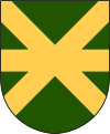
Kävlinge Municipality
|
Kävlinge Municipality Kävlinge kommun |
||
|---|---|---|
| Municipality | ||
|
||
 |
||
| Country | Sweden | |
| County | Skåne County | |
| Seat | Kävlinge | |
| Area | ||
| • Total | 292.45 km2 (112.92 sq mi) | |
| • Land | 152.56 km2 (58.90 sq mi) | |
| • Water | 139.89 km2 (54.01 sq mi) | |
| Area as of January 1, 2014. | ||
| Population (December 31, 2016) | ||
| • Total | 30,532 | |
| • Density | 100/km2 (270/sq mi) | |
| Time zone | CET (UTC+1) | |
| • Summer (DST) | CEST (UTC+2) | |
| ISO 3166 code | SE | |
| Province | Scania | |
| Municipal code | 1261 | |
| Website | www.kavlinge.se | |
Kävlinge Municipality (Kävlinge kommun) is a municipality in Skåne County in southern Sweden. Its seat is located in the town of Kävlinge.
There are nine urban areas (also called a Tätort or locality) in Kävlinge Municipality. In the table they are listed according to the size of the population as of December 31, 2005. The municipal seat is in bold characters.
Barsebäck was the location of a nuclear power plant, opened in the 1970s, but after decades of Danish protests - Copenhagen being located just across the Oresund Sound - it closed in 2005.
Coordinates: 55°48′N 13°07′E / 55.800°N 13.117°E
...
Wikipedia

