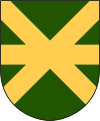
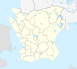
Kävlinge
| Kävlinge | ||
|---|---|---|

|
||
|
||
| Coordinates: 55°47′38″N 13°06′48″E / 55.79389°N 13.11333°ECoordinates: 55°47′38″N 13°06′48″E / 55.79389°N 13.11333°E | ||
| Country | Sweden | |
| Province | Skåne | |
| County | Skåne County | |
| Municipality | Kävlinge Municipality | |
| Area | ||
| • Total | 4.68 km2 (1.81 sq mi) | |
| Population (31 December 2010) | ||
| • Total | 9,049 | |
| • Density | 1,932/km2 (5,000/sq mi) | |
| Time zone | CET (UTC+1) | |
| • Summer (DST) | CEST (UTC+2) | |
Kävlinge is a locality and the seat of Kävlinge Municipality, Skåne County, Sweden with 9,049 inhabitants in 2010.
In 1996, a train containing large amounts of ammonia derailed and around 9,000 people had to be evacuated from the area. This was the biggest evacuation operation in Swedish history.
Near Kävlinge is the site of the Hög passage grave, a Bronze Age barrow covering a neolithic burial chamber. Hög means mound from the Old Norse word haugr for hill. The finds from the excavations are in the Lund University Historic Museum.
Kävlinge is located north of Lund and has a river passing through called Kävlingeån (translated Kävlinge River). The river played an important role at the events leading up to the Battle of Lund, which was a battle in the Scanian War.
...
Wikipedia


